|
|
|
|
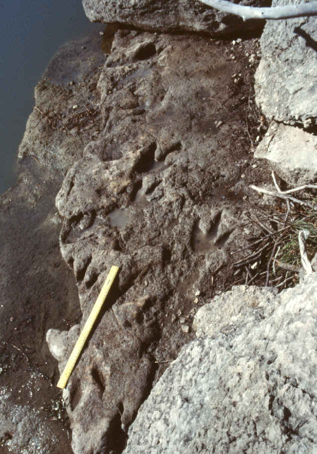
| Theropod tracks at Blue Hole |
Blue Hole and Opossum Branch
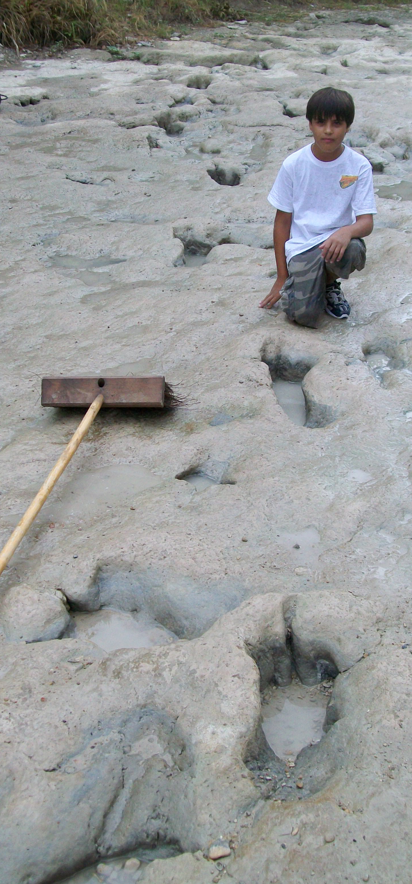
The Blue Hole (Track Site #4 in park literature) is a deep hole in the Paluxy River. Legend has it that it is bottomless, but its actually about 20 to 25 feet deep. It's a popular fishing and swimming site, where visitors can enjoy cool water even when the rest of the river is largely dried up (as sometimes happens in late summer). It's also one of the best track sites in the park. Between the large boulders (which have fallen down from the overlying Thorp Springs bed). the rock shelves on the east bank here contain numerous dinosaur tracks, including some of the largest theropod tracks in the park, some unusually small (probably juvenile) prints, some very deep prints, a few probable sauropod tracks, and various faint and imperfectly preserved tracks. Some of the tracks are so deep here that the toes punch through to the softer blue clay that underlies the track bed. Often these very deep tracks look essentially like holes until one removes all the mud, and reaches inside to feel the deep toe and claw impressions.
|
|
|
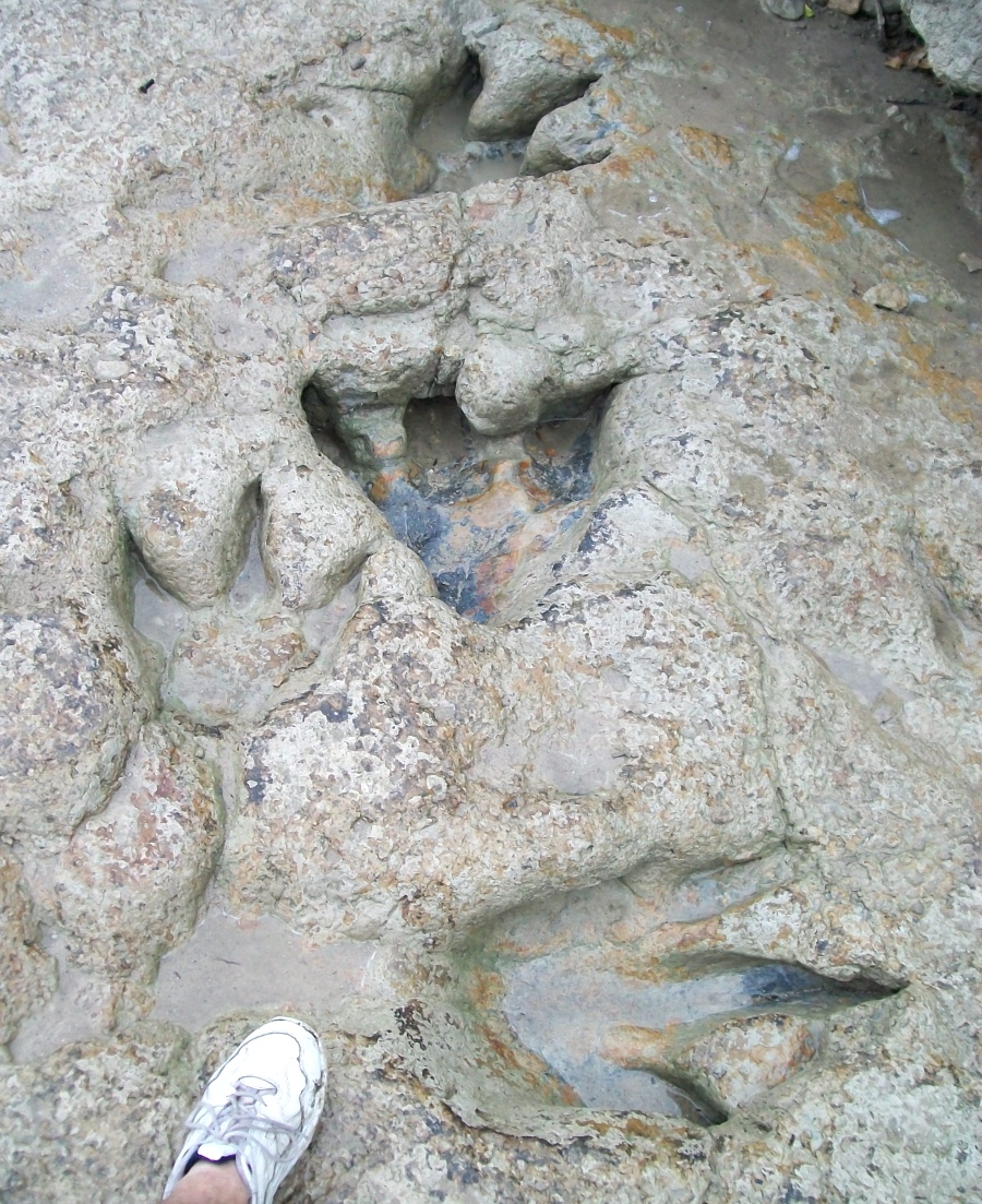
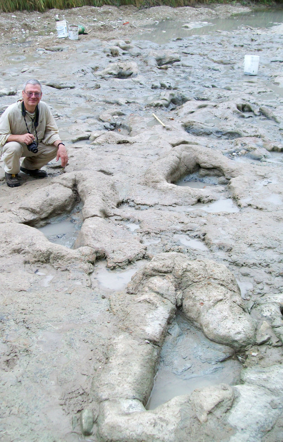
Oppossum Branch | Metatarsal tracks south of Blue Hole |
There are four main track exposures along the Blue Hole. The first may be viewed from a top the overlook, across from the Gift shop. A metal pipe there focuses on one of the better tracks. To view more of the tracks, however, one must hike down a dirt path to the river bottom. The first track area is easily seen on the right. To see the other tracks exposures, you must climb over some large boulders, heading north. Unfortunately, several tracks have been lost as portions of the shelves have fallen into the riverbed. Tourists using the edge of the cracked track bed as a diving board do not help. Fortunately many good tracks remain here, including one I freshly uncovered from under mud and a large rock in 2004 (with park permission).
Just south of the Blue Hole numerous tracks occur on both sides of the riverbed for about 200 meters. Many are deep and mud collapsed. Those near the banks are typically less eroded and more distinct. Several tracks that once existed on a broken section of the track bed along the east bank here have since broken away. Among them was a striding trail of metatarsal tracks. Fortunately, I was able to map that exposure before this occurred.
|
|
|
|
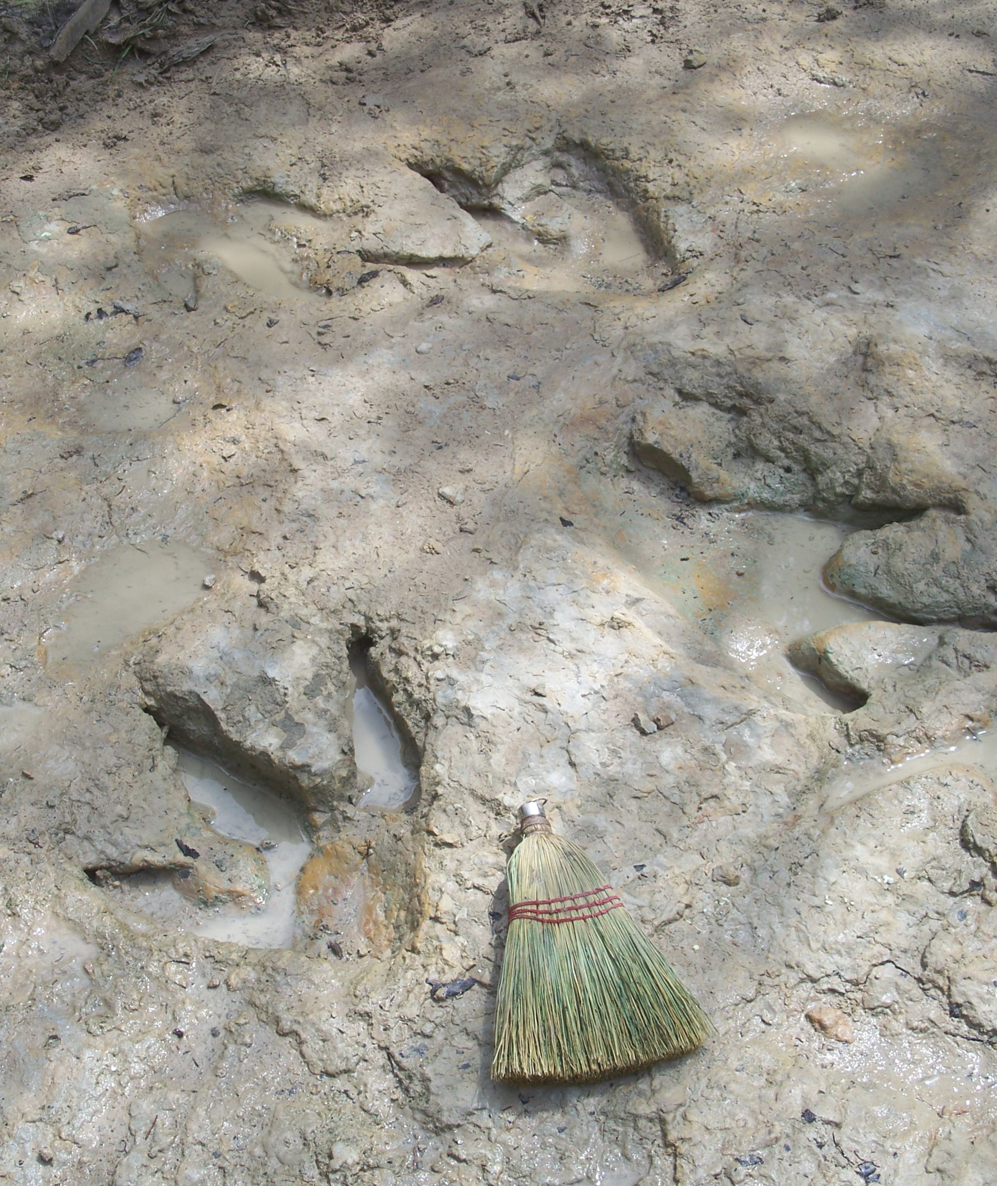
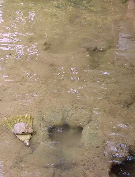
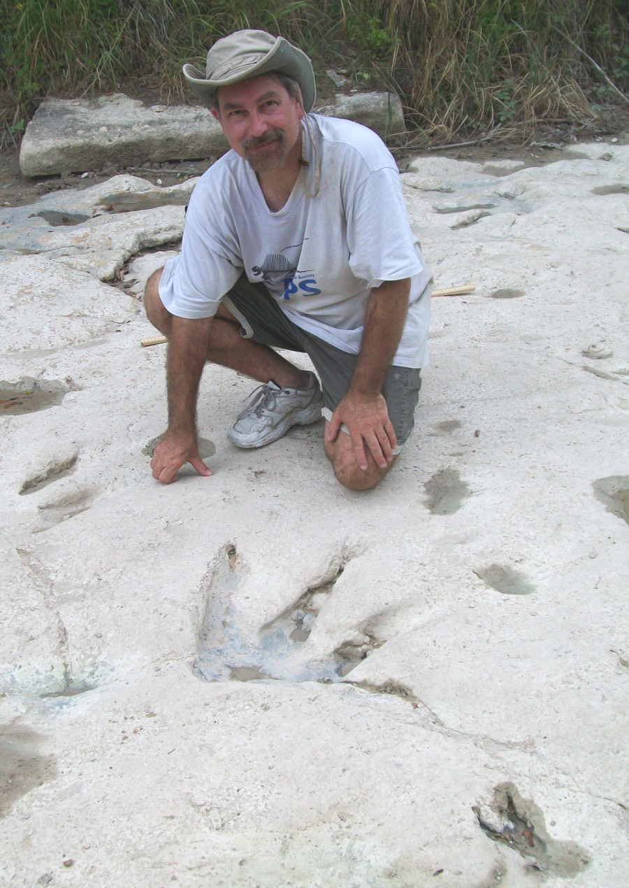
Ballroom Site (South of Blue Hole), (C) 2009, Glen Kuban (Left) James Farlow with sauropod trail (Center) Young helper with metatarsal trail (Right) Glen Kuban with theropod tracks | ||
In 2009 several coworkers and I, led by Dr. James Farlow of Indiana/Purdue University, cleaned, photographed, and largely mapped this last large area of the park that had not been previously mapped. It contains over 300 interesting tracks, many deep and well preserved, including a trail of large sauropod tracks, a juvenile sauropod trail, several trails of distinct theropod tracks, many deep and mud collapsed theropod tracks, several trails of metatarsal theropod tracks, and a problematic invertebrate trail. We dubbed it the "Ballroom" site for obvious reasons, and will be publishing more details soon.