|
|
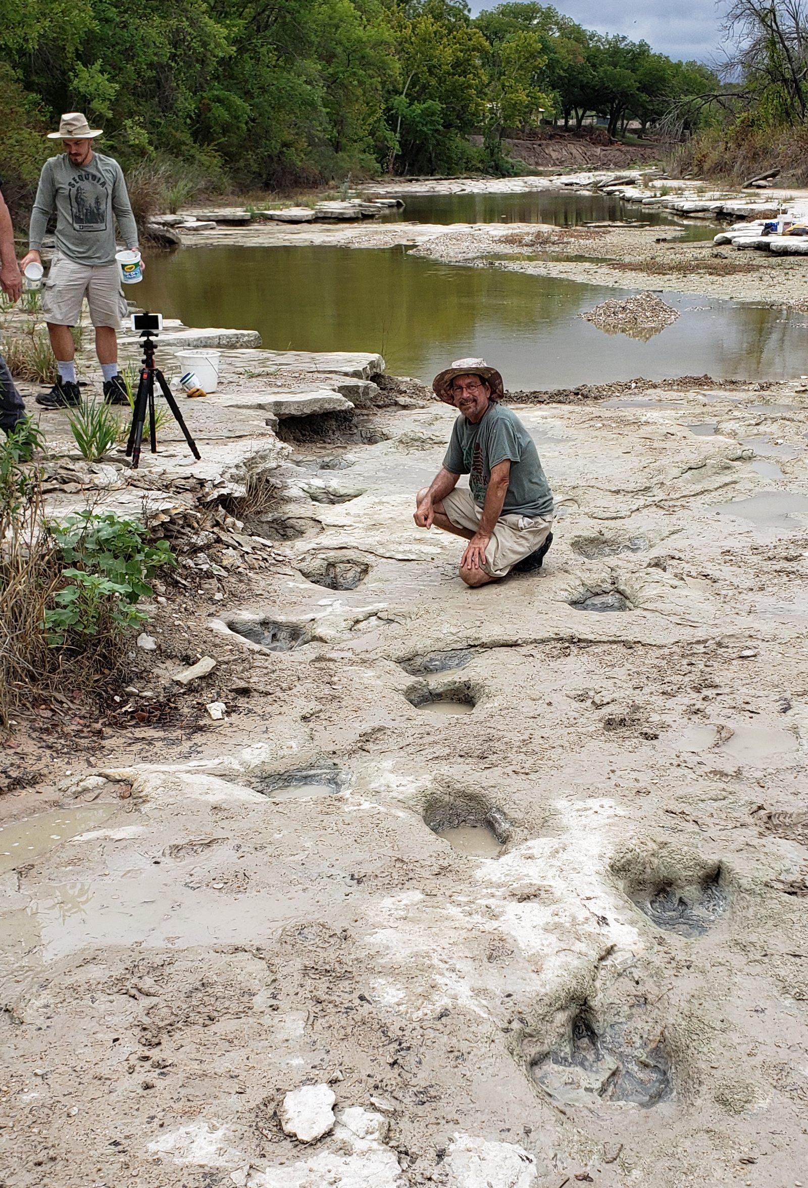
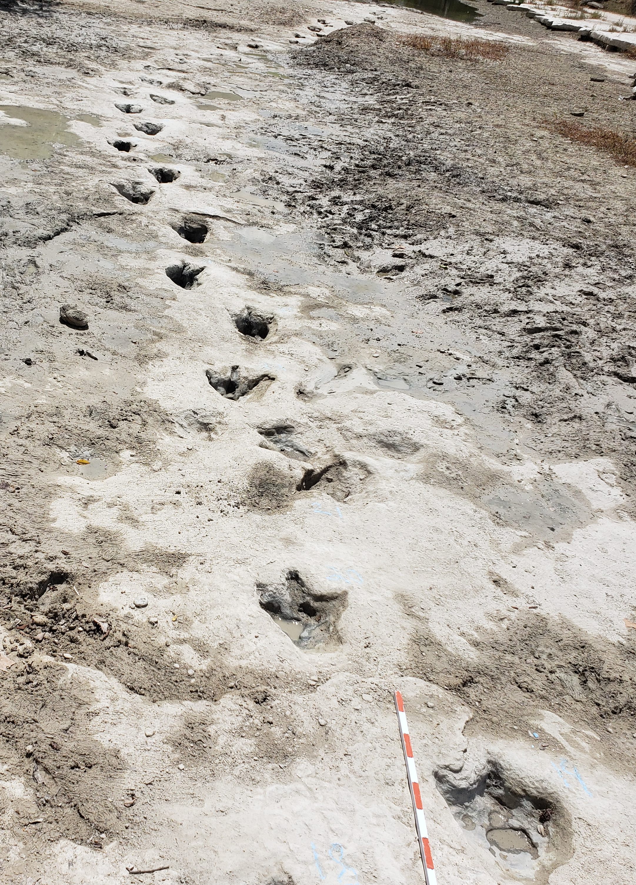
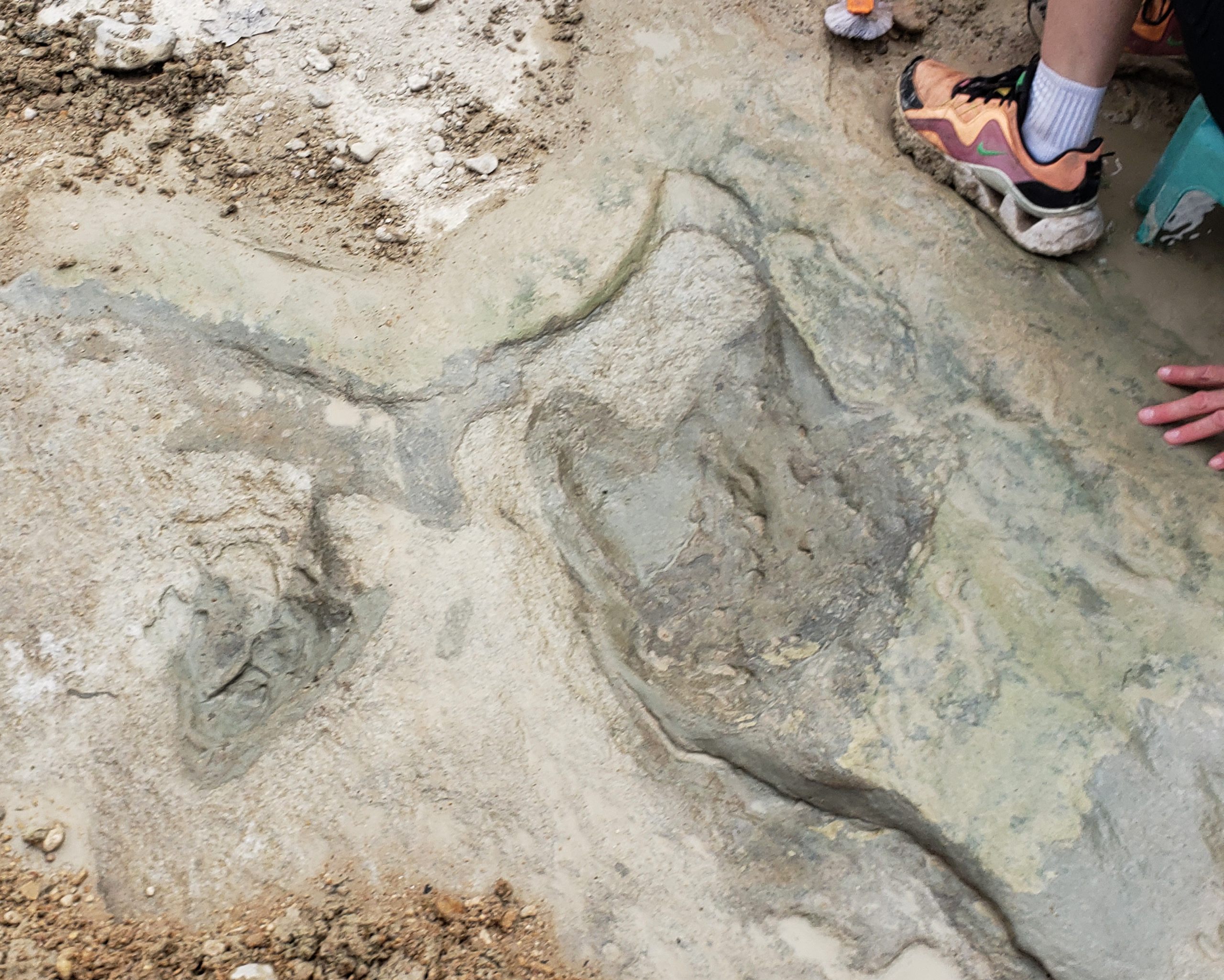
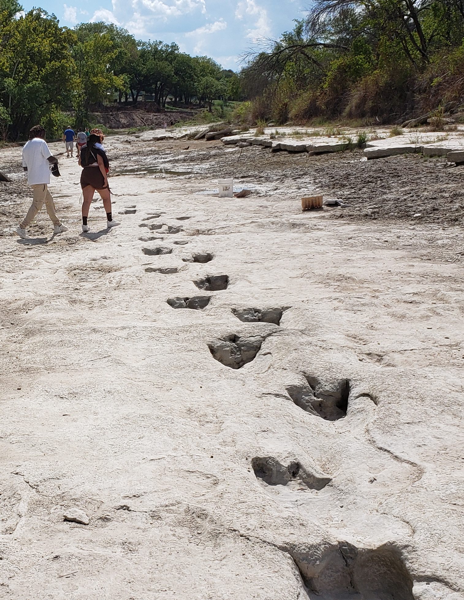
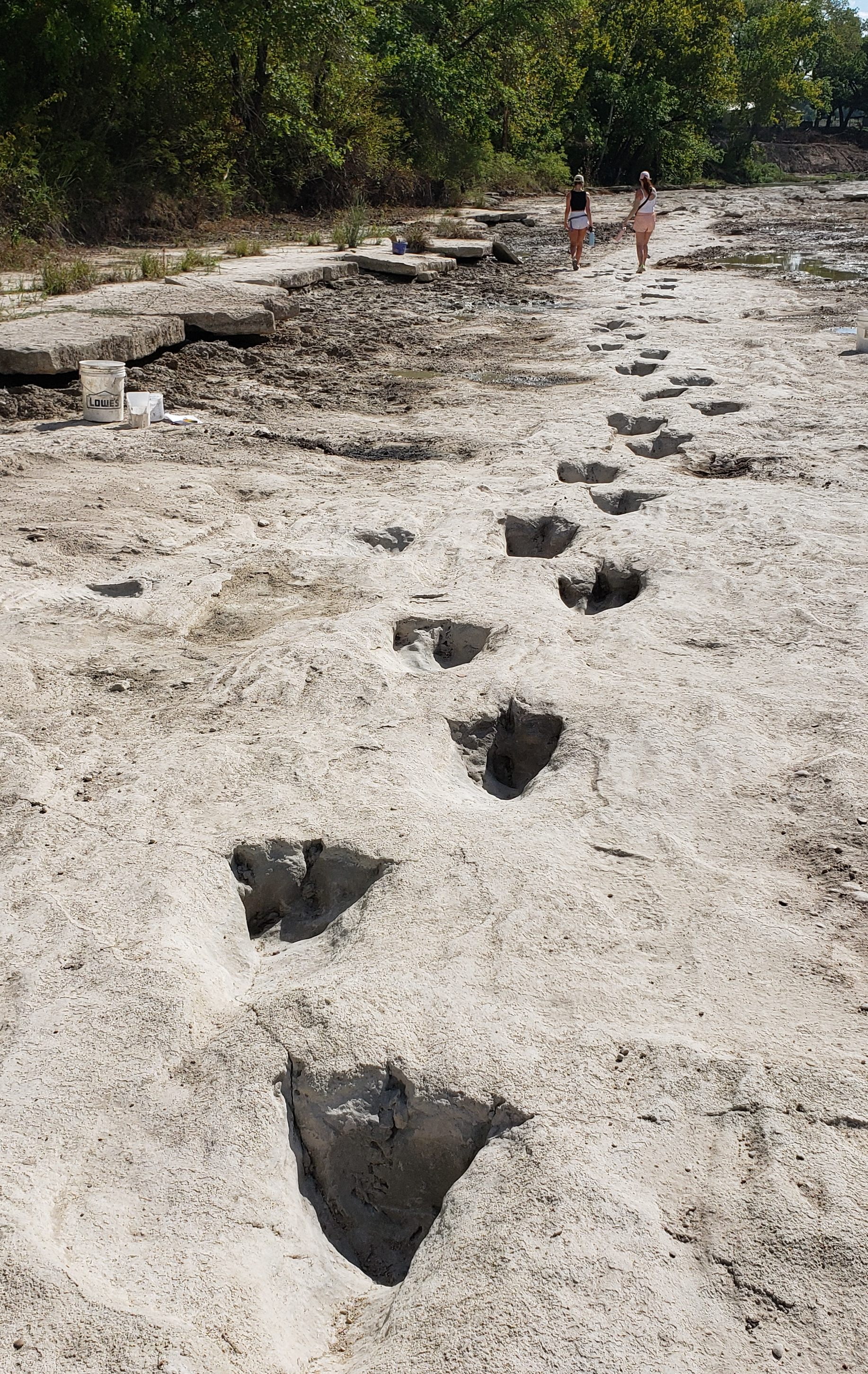
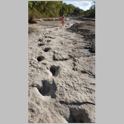
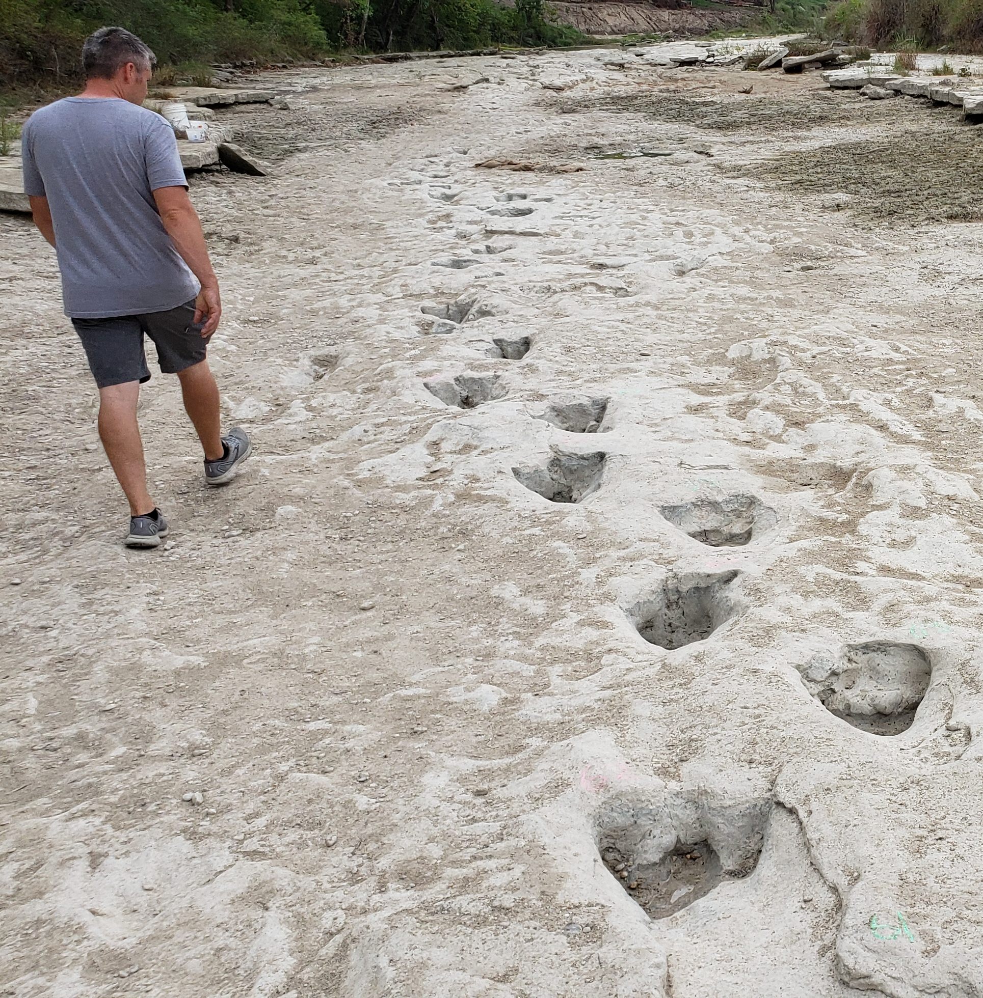
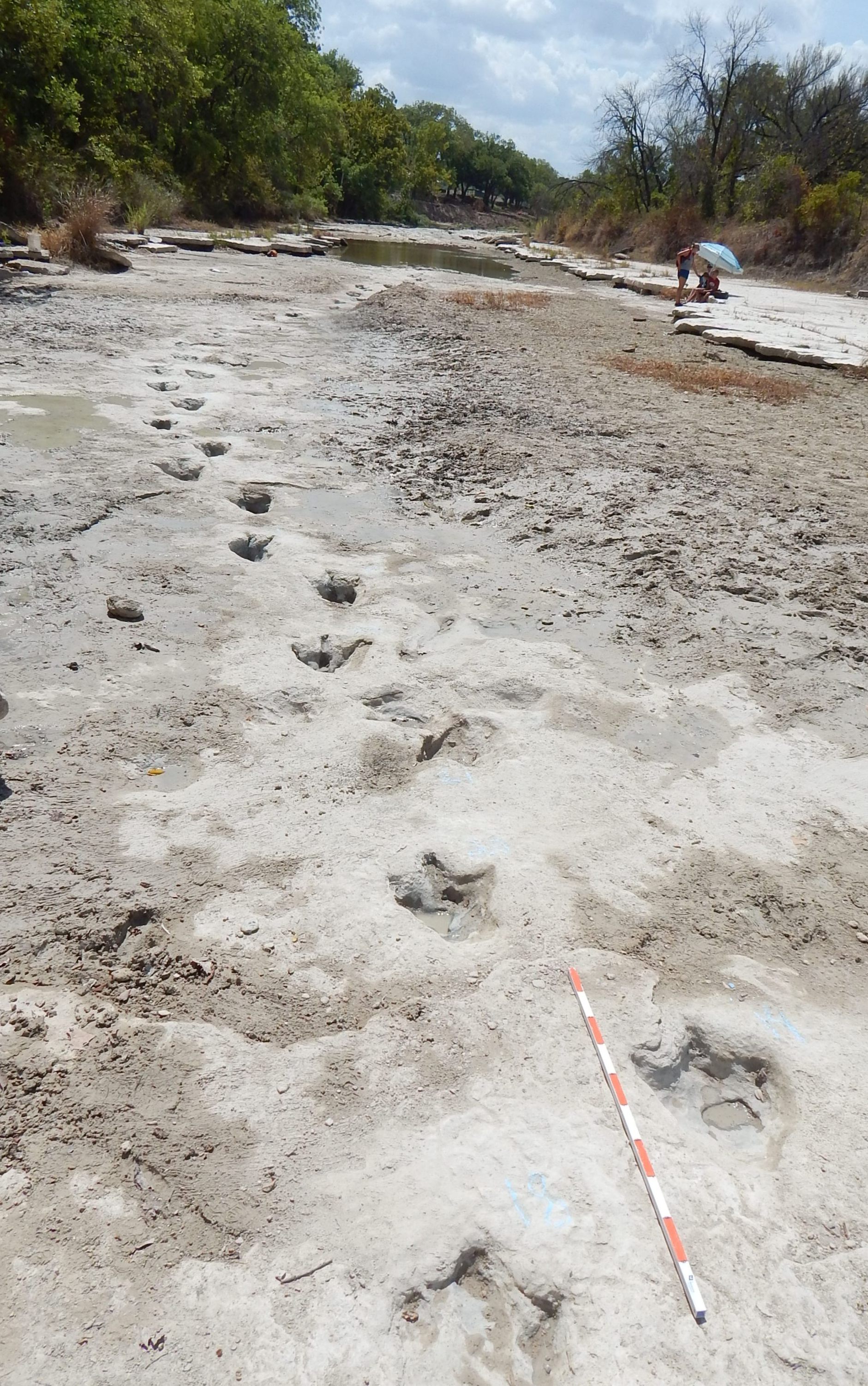
The western end of the Long Trail crosses the renown Taylor Site proper, dominated by many trails of elongate, largely infilled metatarsal (heel impressed) dinosaur tracks once mistaken for "human" footprints. Ron Hastings and others often joined me in progressively mapping these and many other tracks at the Taylor Site and surrounding areas in the 1980s and early 1990s, including about two dozen tracks in the Long Trail (indicated in our maps as the IID Trail). Our photos and maps of these trails can be seen in the "Taylor Site" link of my Paluxy Photo Gallery.
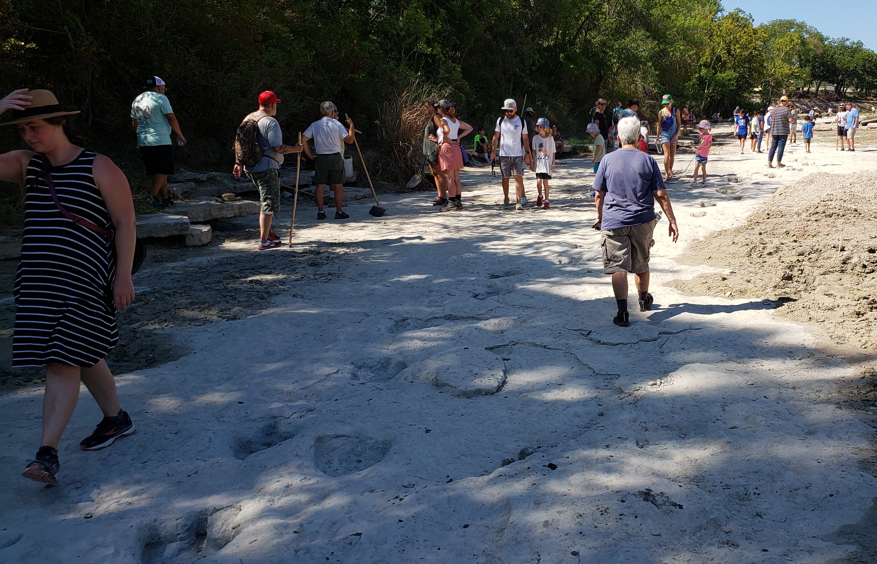
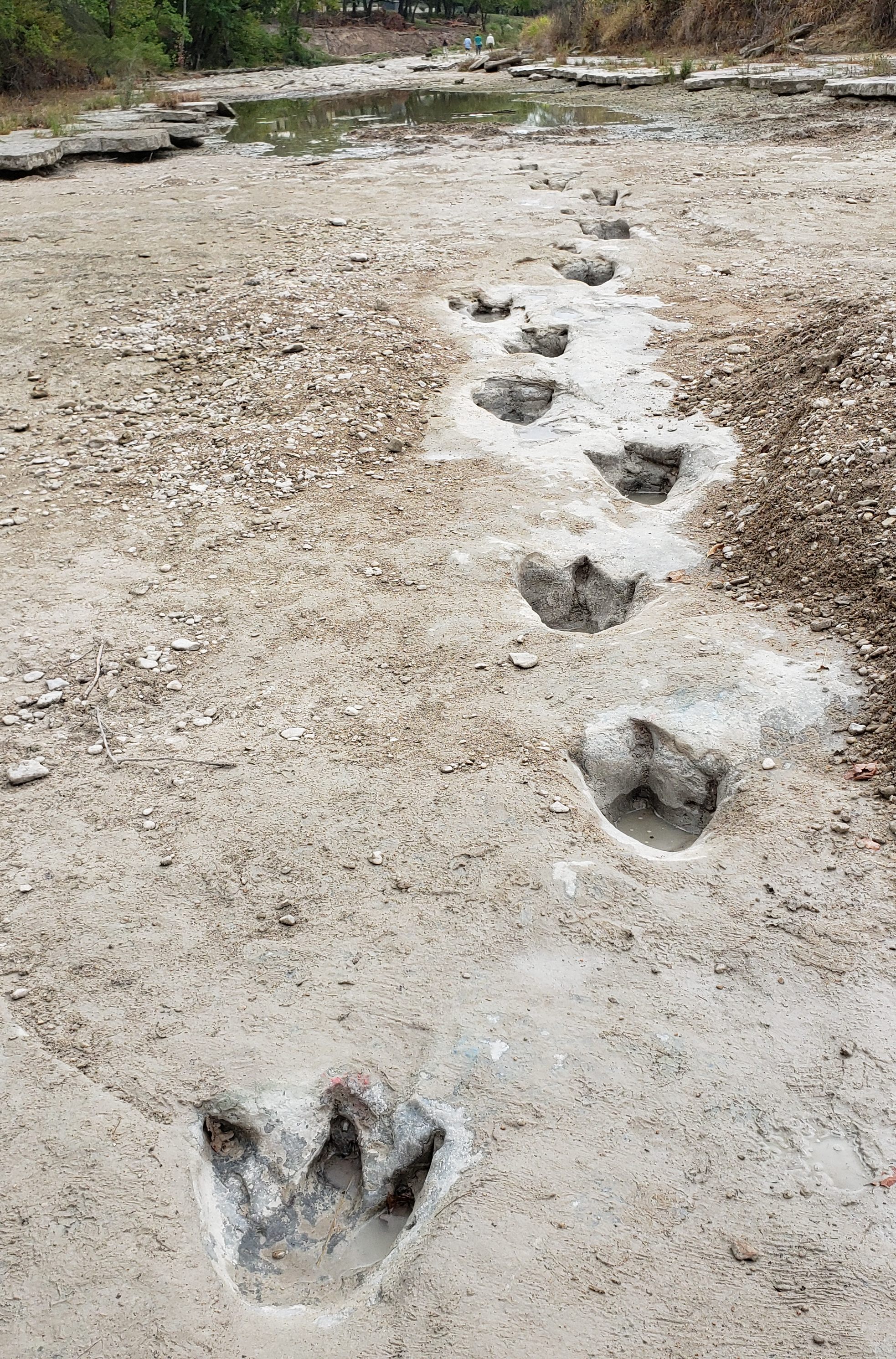
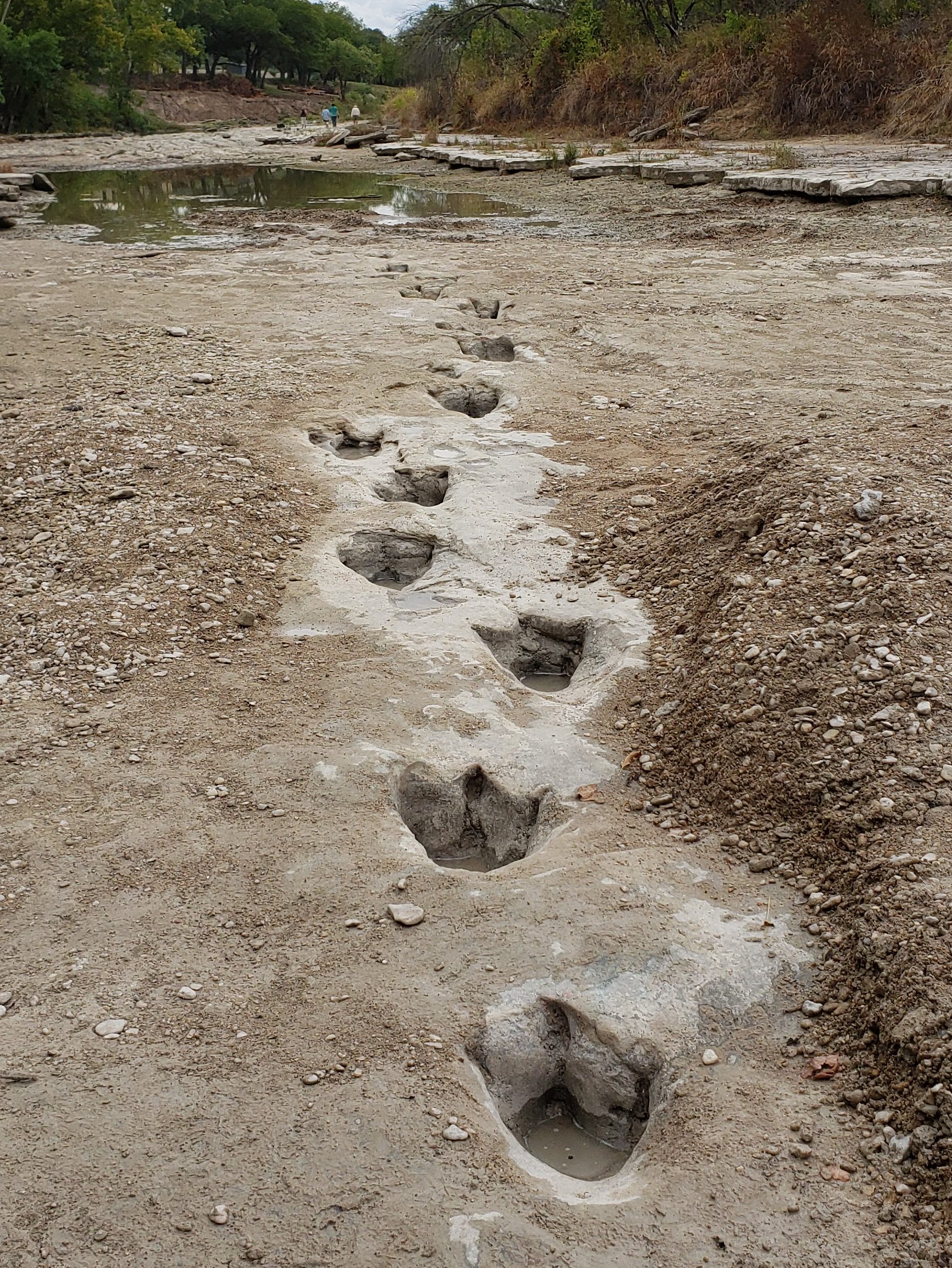
During a severe drought in the summer of 2000, the entire Long trail and some of the tracks crossing it were exposed and largely mapped by a group of young-earth creationists. However, few Glen Rose visitors got to see it then or since. This is partly because even during dry periods (typically late summer) large portions are often still under mud, gravel and/or shallow water water. However, another unusually severe drought occurred in the summer of 2022, affording another rare opportunity to re-expose the entire Long Trail and even more tracks around and beyond it, and allow many more people to see and enjoy these remarkable wonders. When I learned of the drought in August, I headed for Glen Rose as soon as possible, in hopes of doing this, as well as documenting previously unmapped tracks in other unusually low and seldom accessible areas of the riverbed (with the help of others of course).
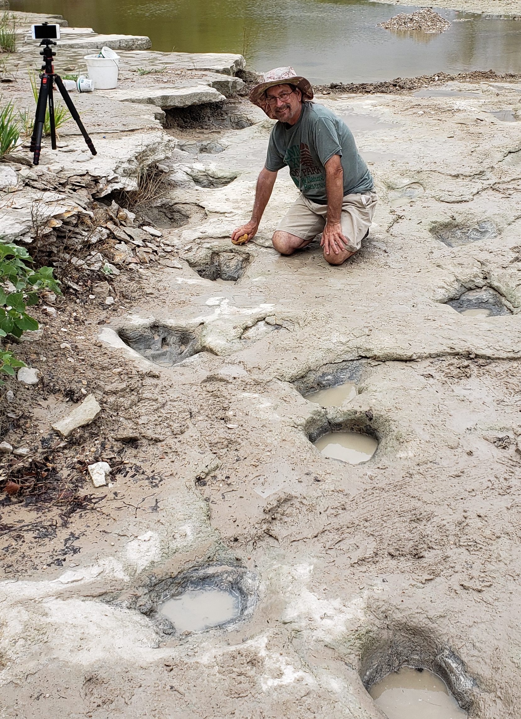
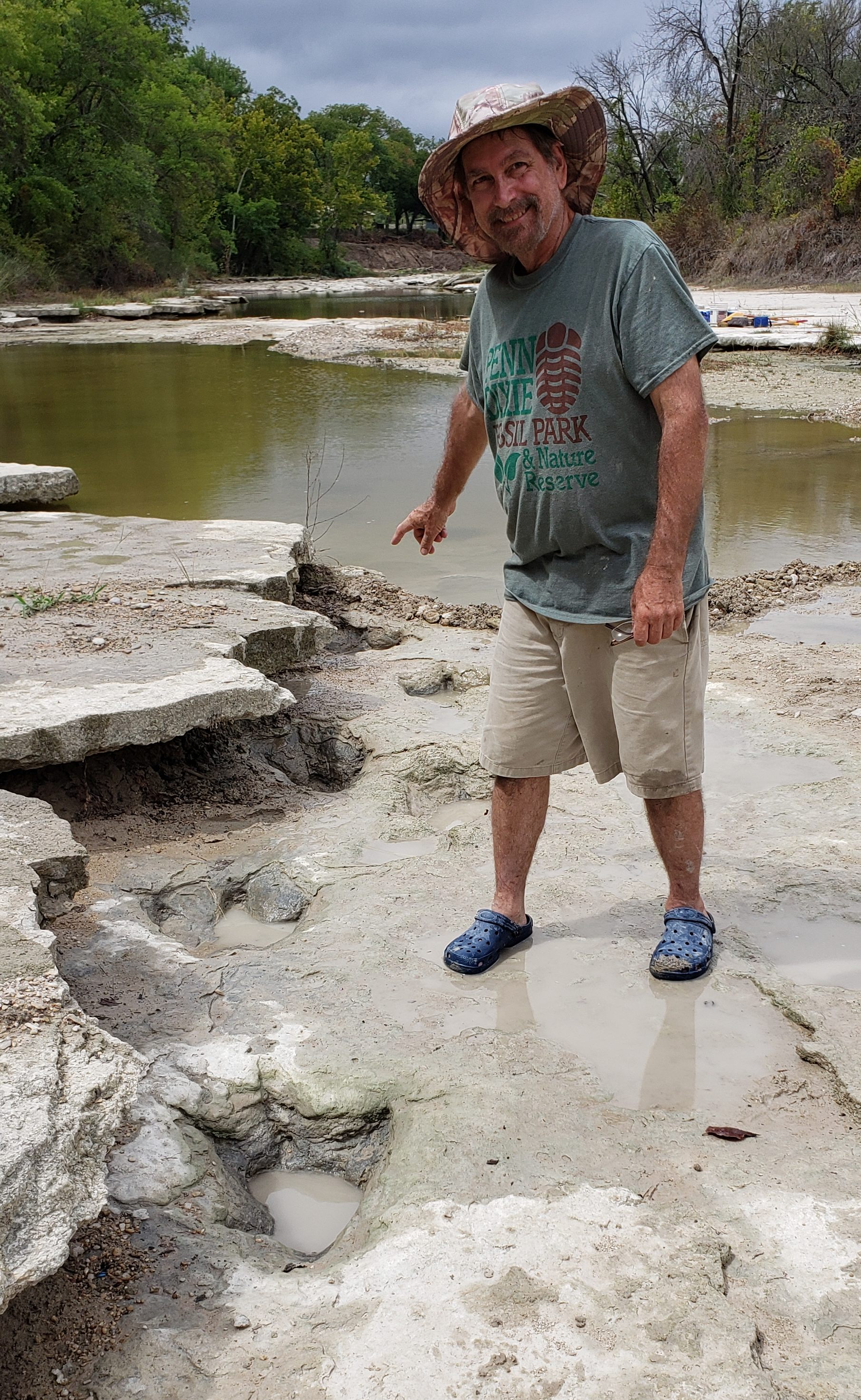
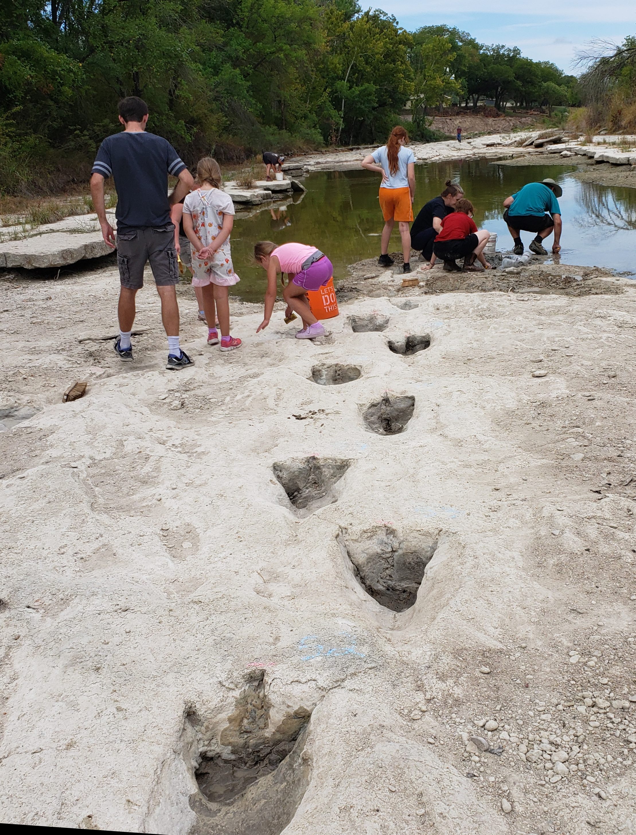
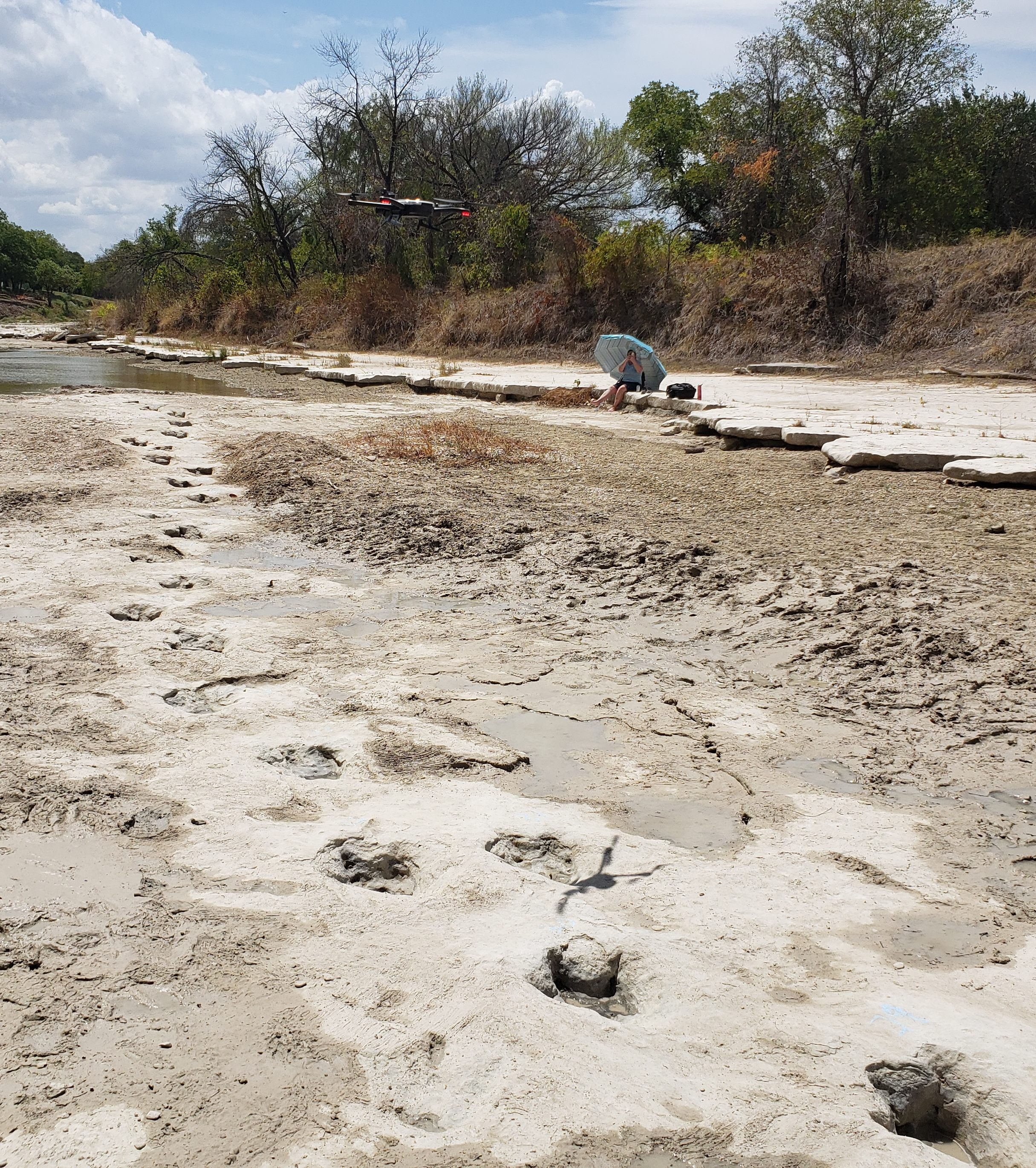
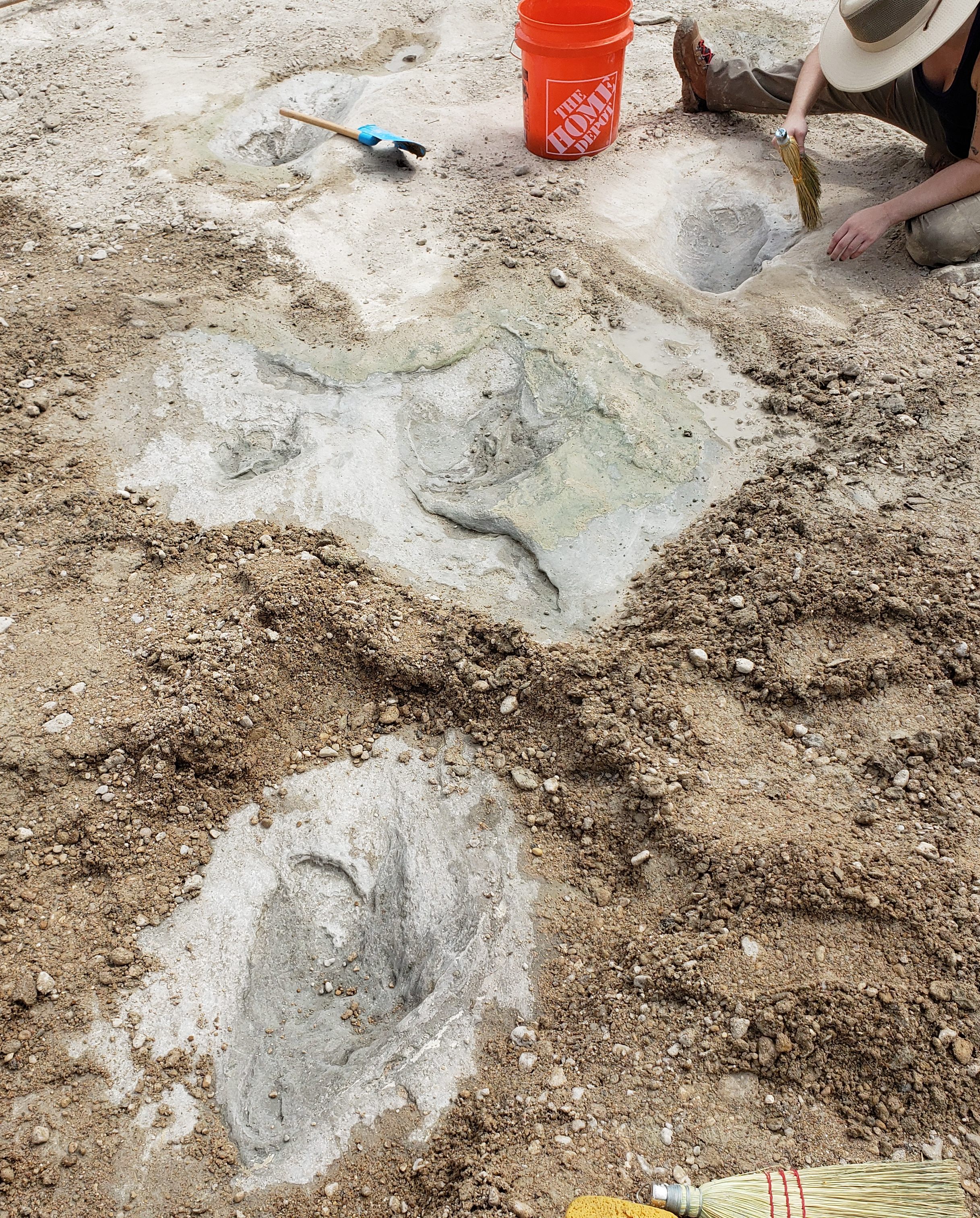
Upon arriving in Glen Rose, and with the cooperation of Dinosaur Valley State Park which owns the land bordering the site, I and some coworkers organized a large group of volunteer workers, including members of the Dallas Paleo Society, the Master Naturalist group, and "Friends of Dinosaur Valley." several friends and previous coworkers, and a number of park staff. Each day over two dozen of these enthusiastic workers (as well as interested visitors who joined in) ranging in age from small children to retired seniors, worked diligently with shovels, trowels, scoops, brooms, and whisks to expose and clean as many tracks as possible, despite searing heat and grimy conditions. Soon after we began working we also had to contend with intermittent and overnight rains, requiring repeated use of water pumps and buckets to bail out two large water pools. After about 10 days we finally succeeded in exposing the entire long trail, as well as several trails (or portions thereof) that cross it, and many nearby tracks (some previously mapped, but many never seen or fully documented before).
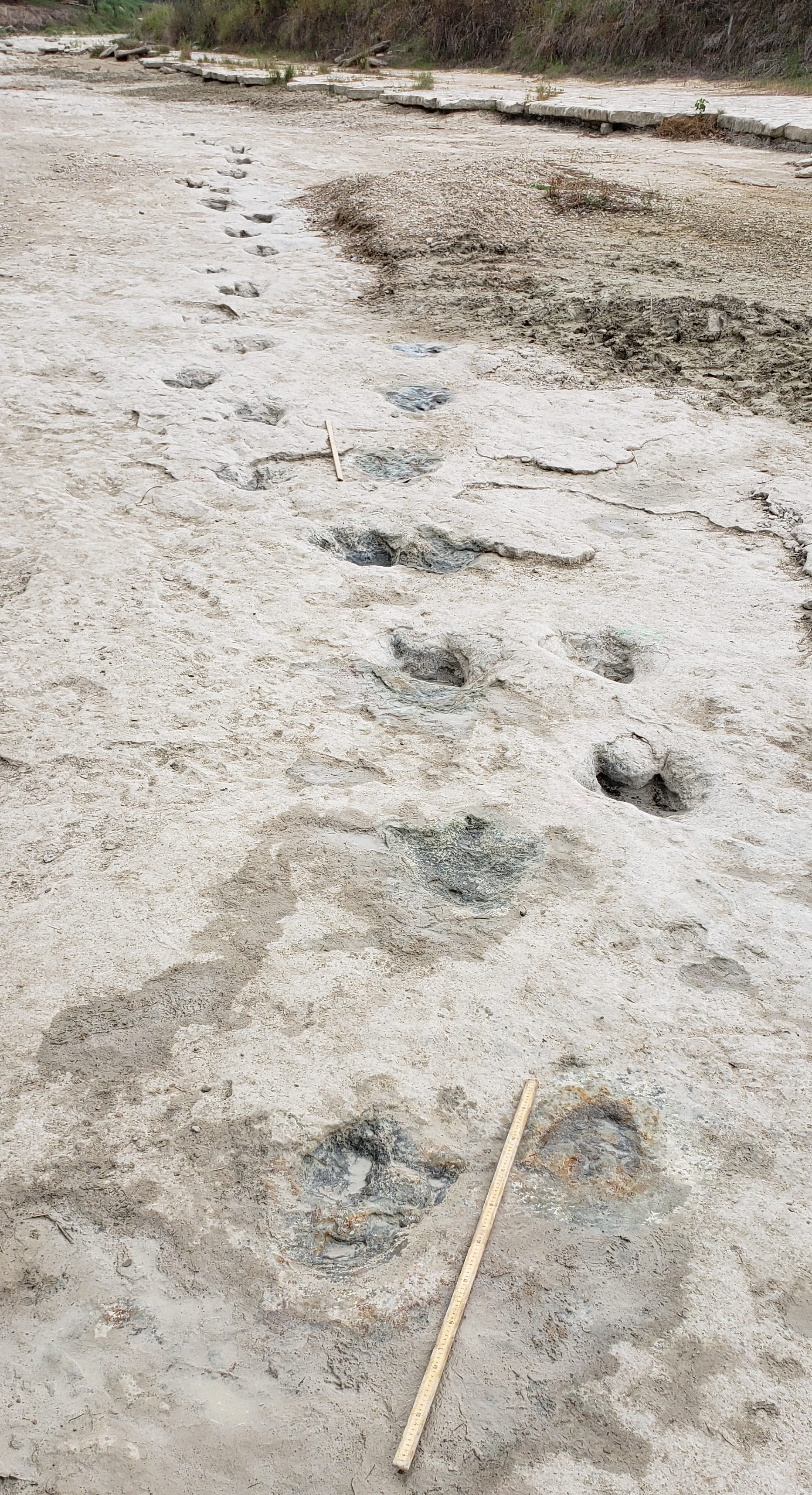
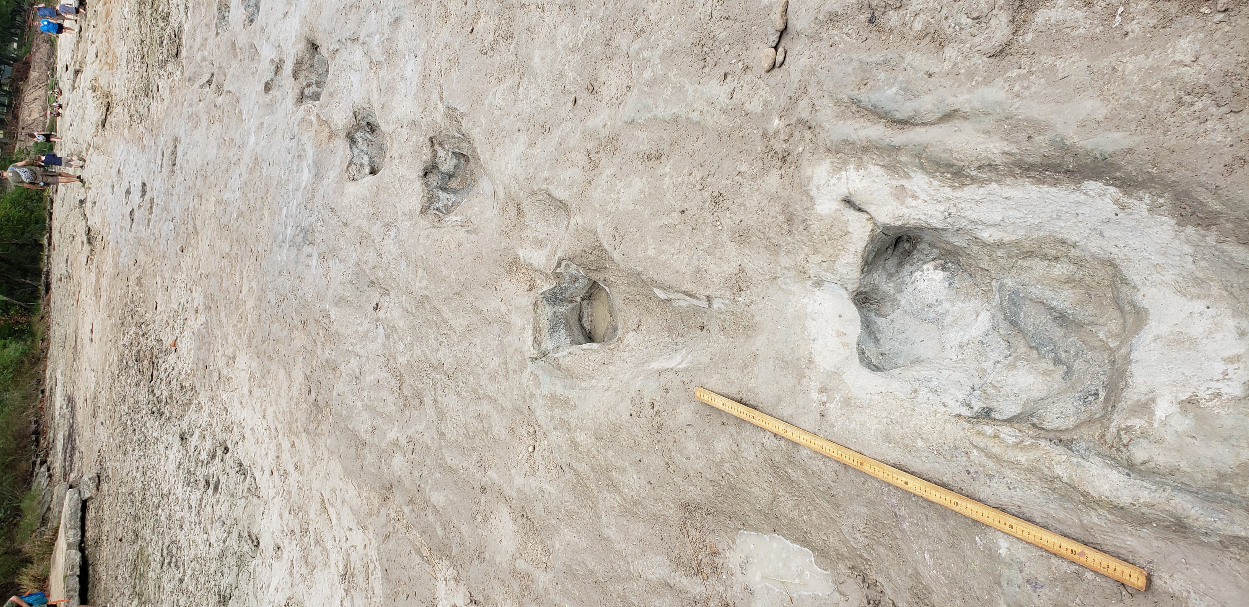
Many photos and videos were taken, and several of us measured all the track paces and stride lengths in the long trail and many nearby tracks (those not previously mapped). Assistant park superintendent Asa and some local drone pilots did the first known drone filming of the long trail (see drone footage links below), and nearby tracks in a clean dry condition. (In 2017 the BBC filmed me walking along the long trail, but most of it was under shallow water at the time).
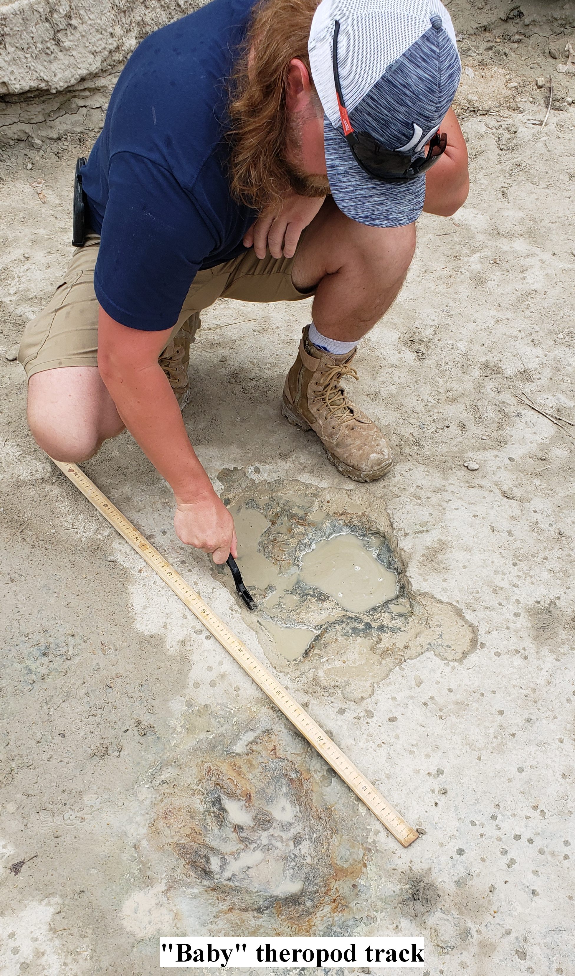
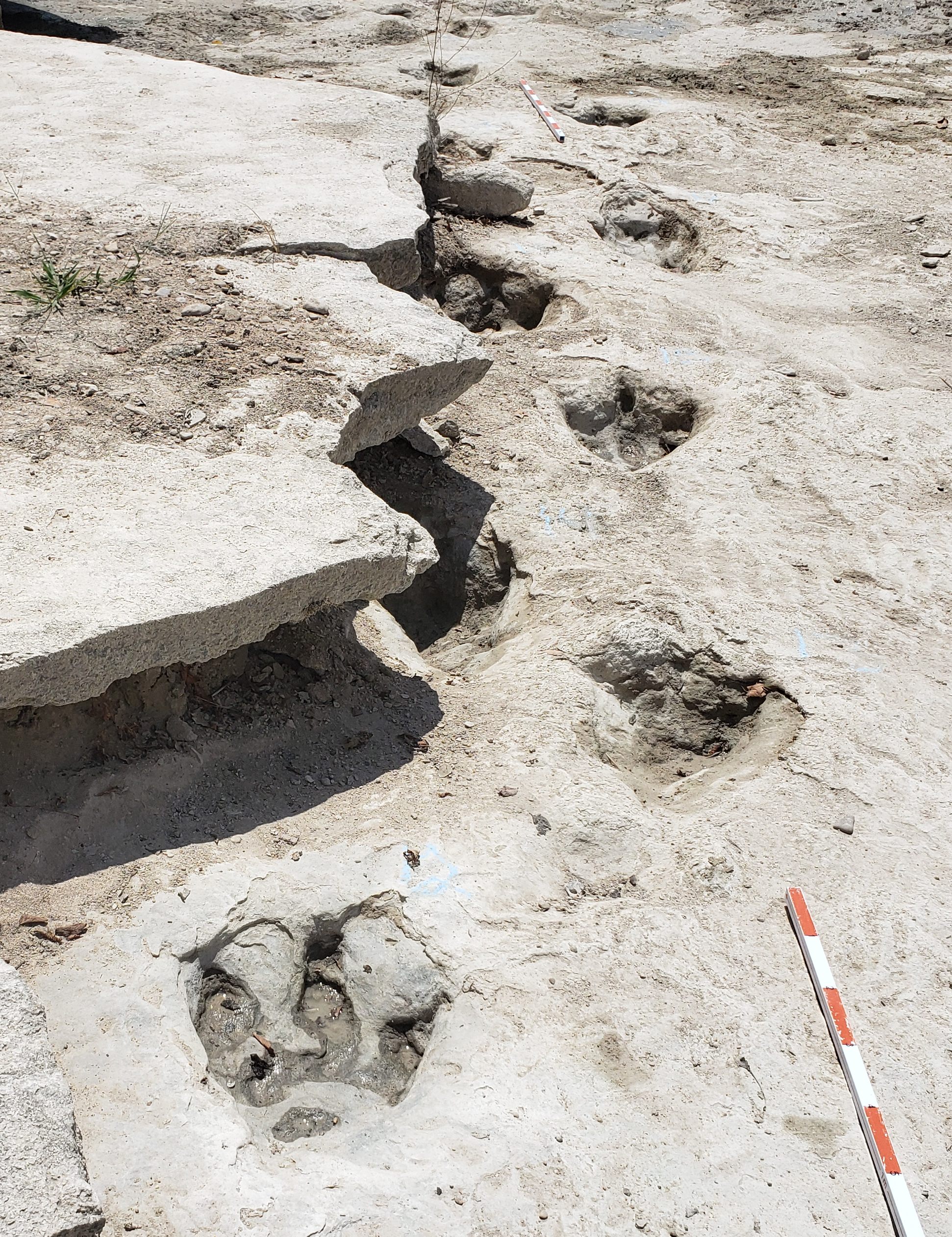
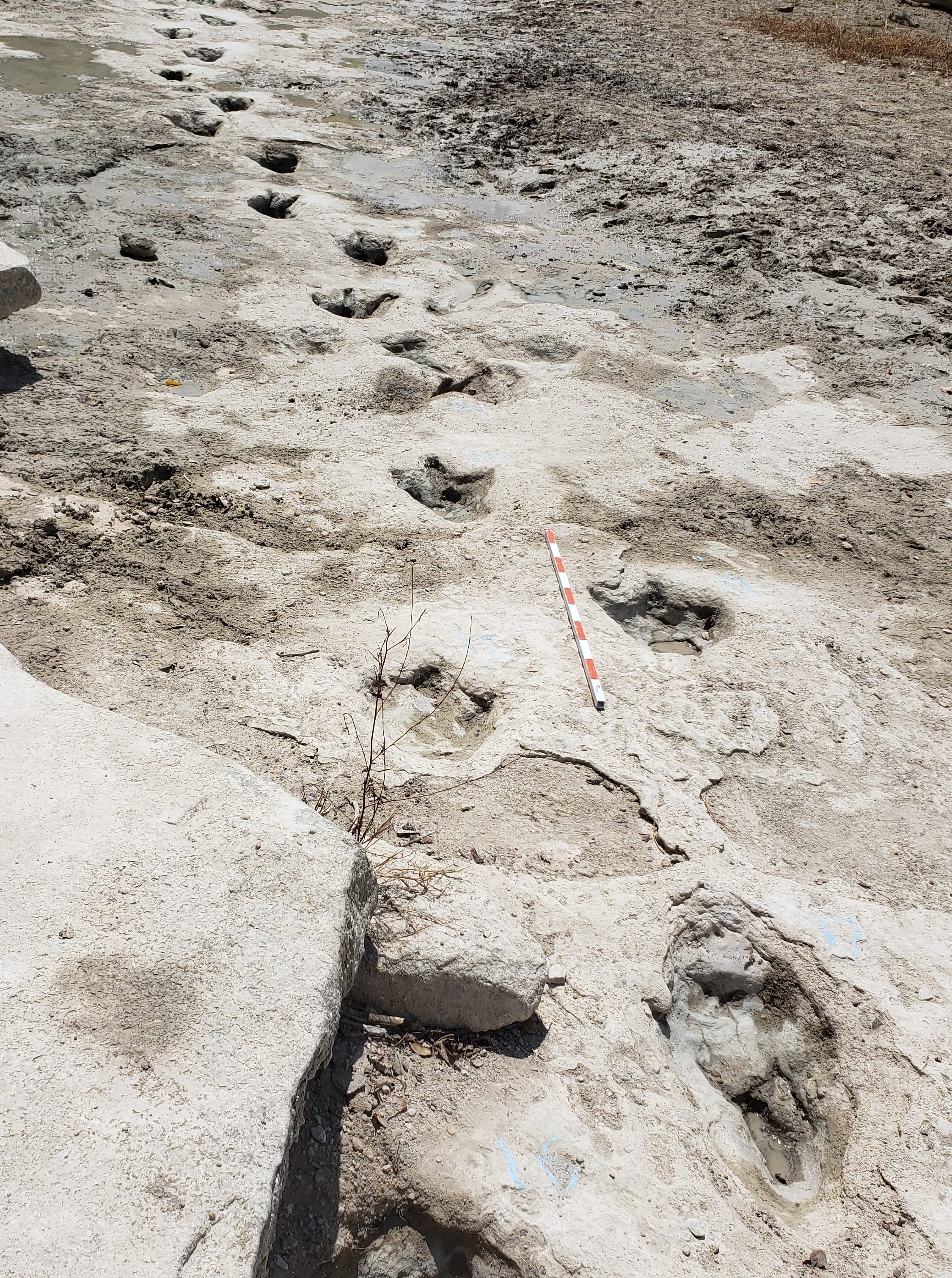
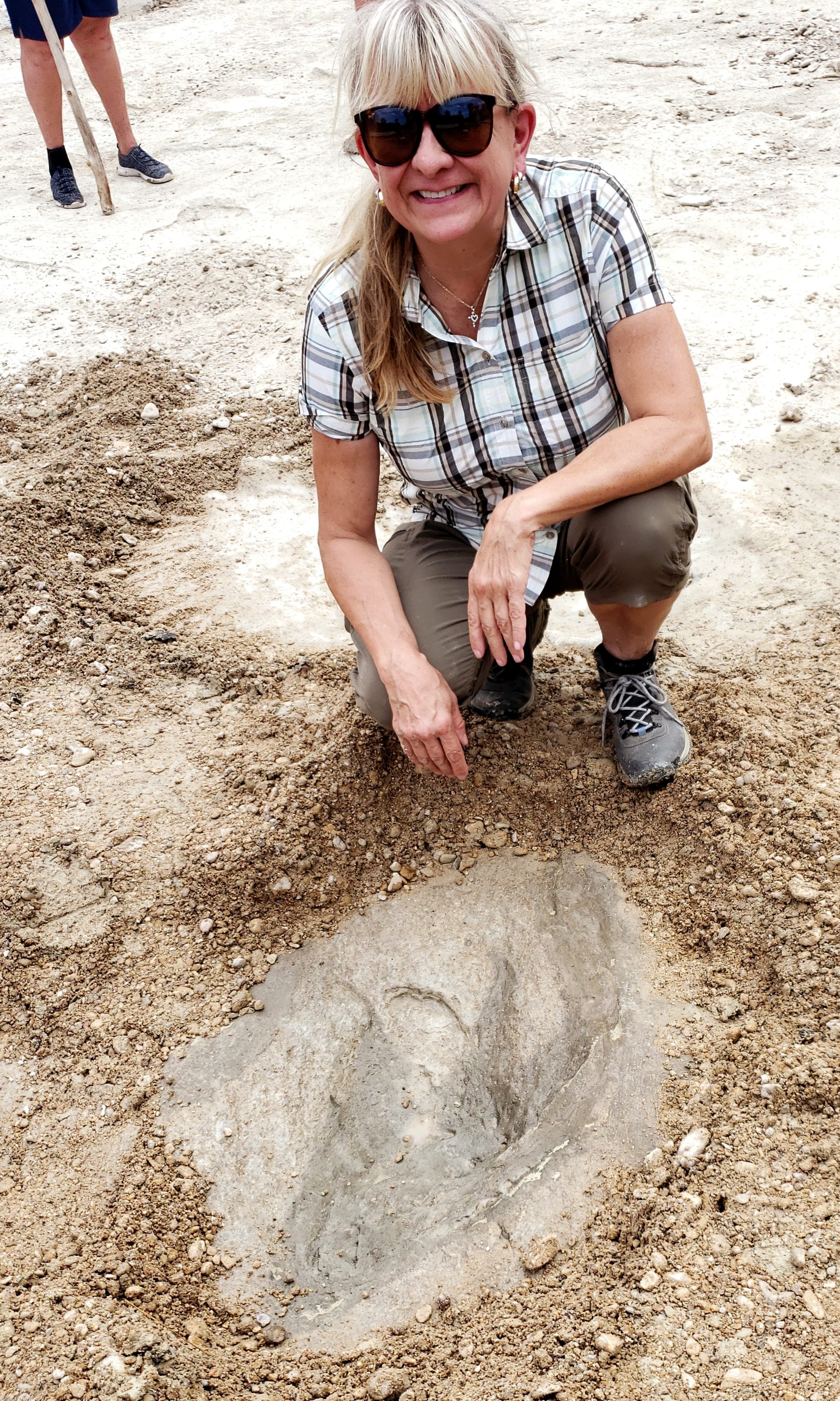
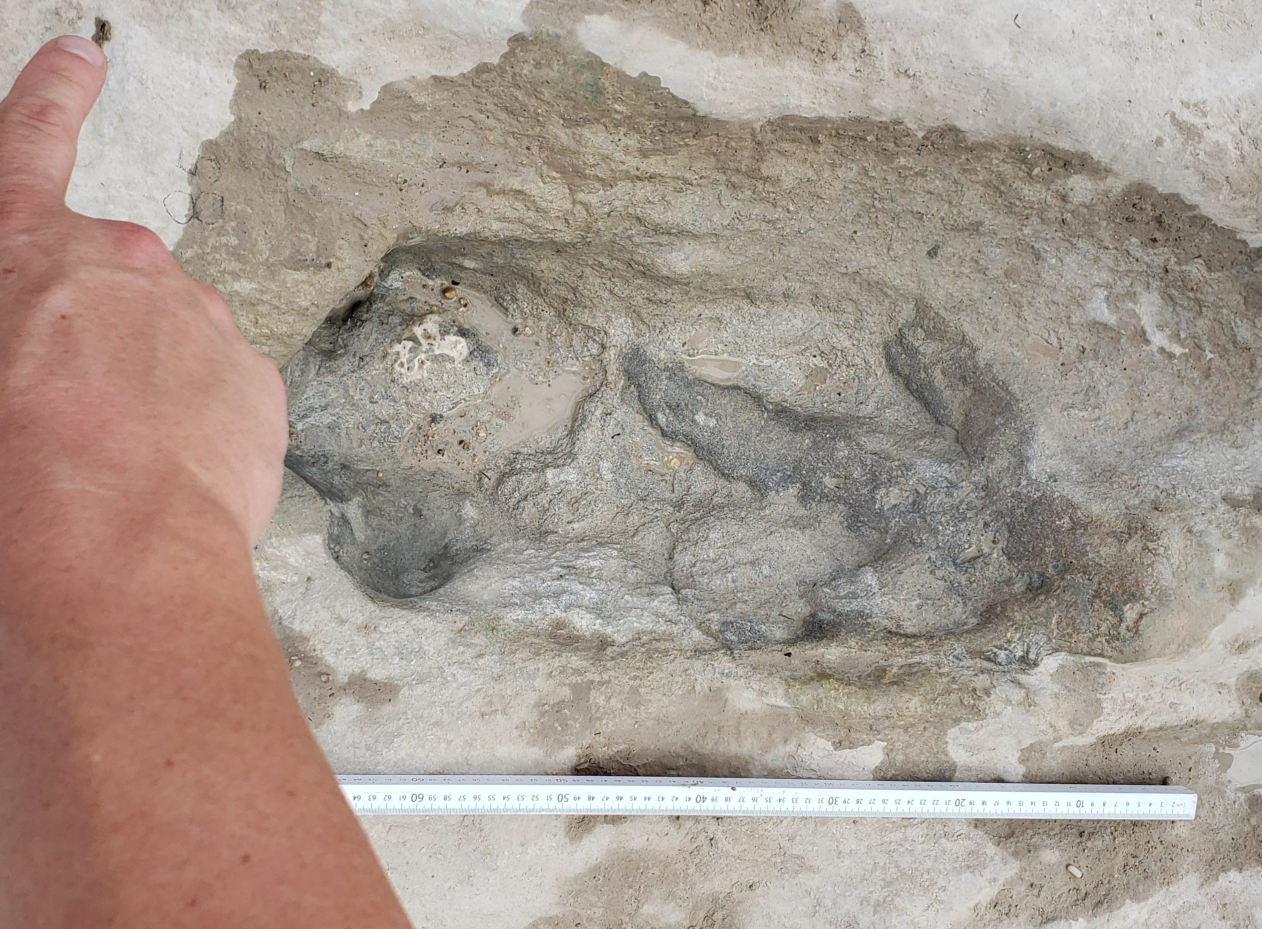
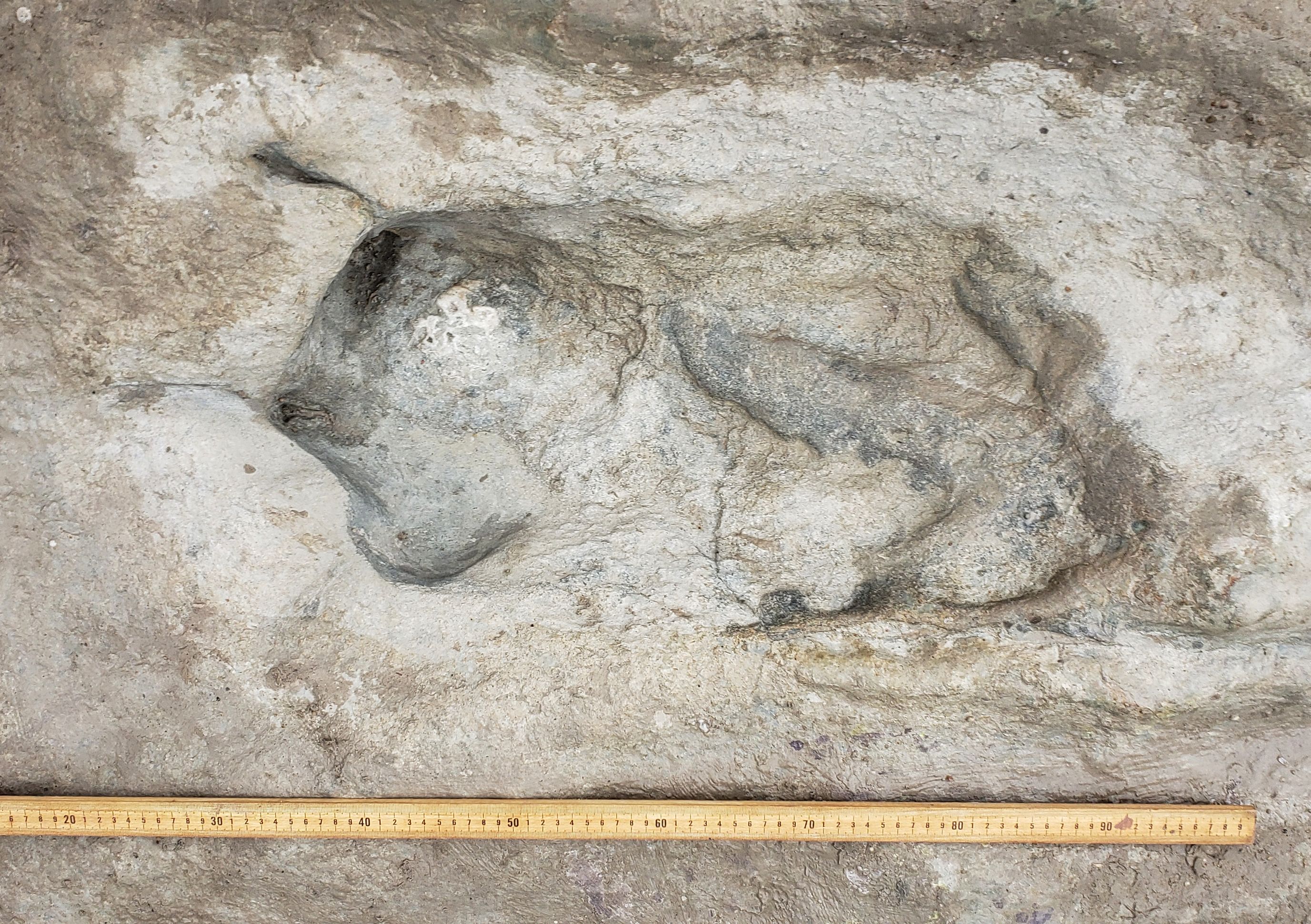
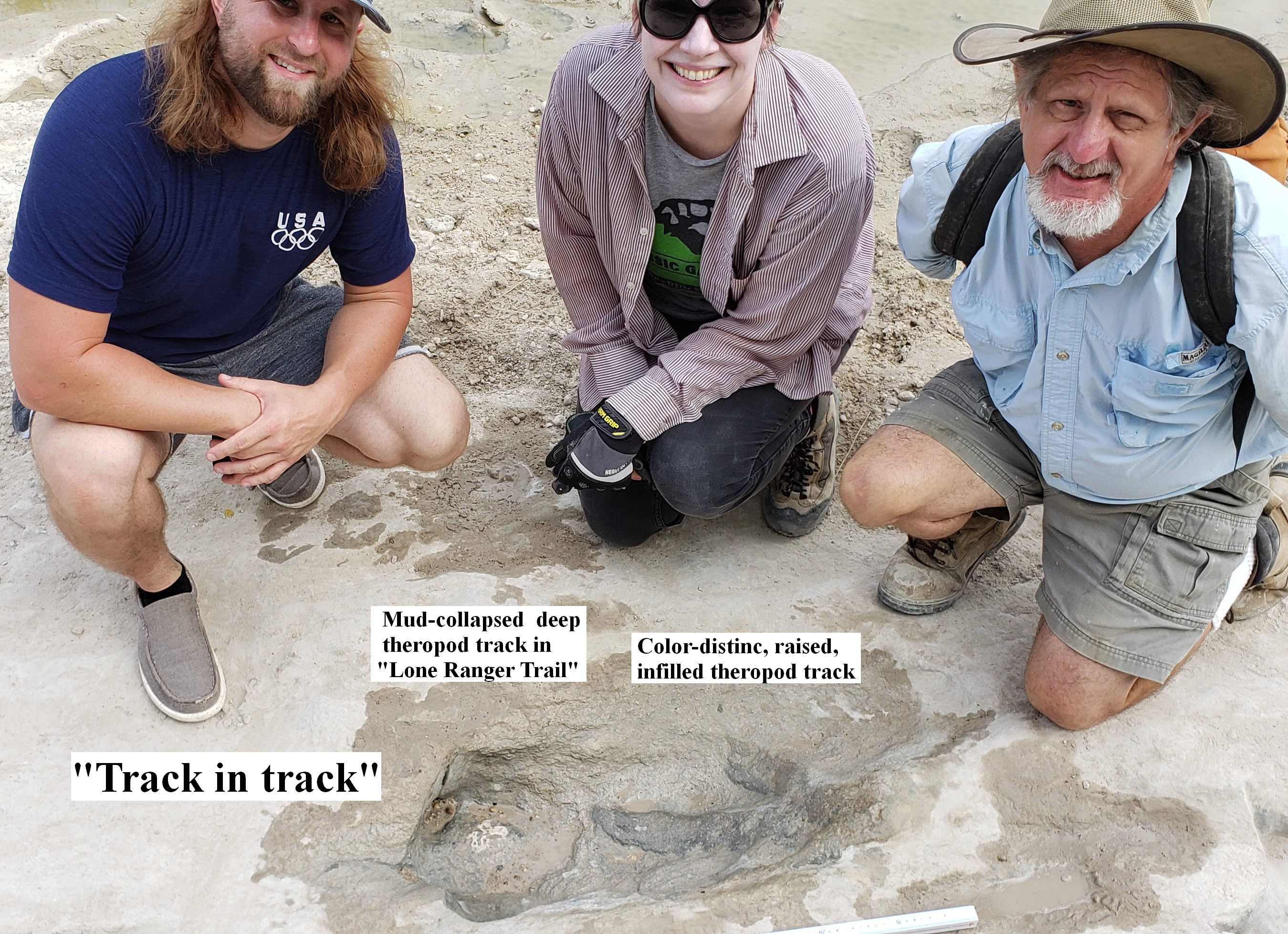
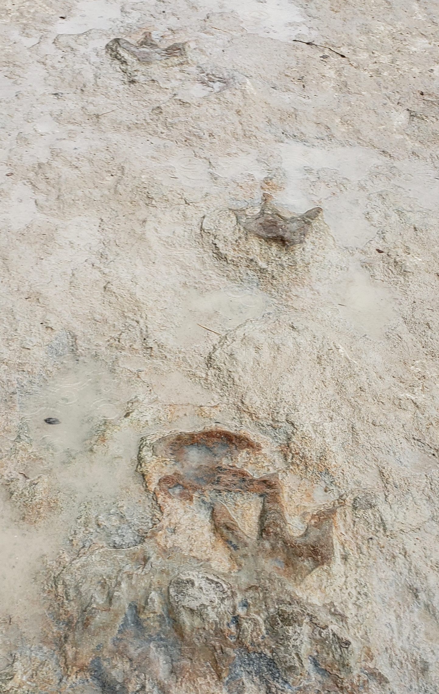
Among the most interesting new finds was a curious "track in track"-- that is, a raised-relief, infilled, color-distinct track overlapping one of the deep tracks in the Long Trail). Also exposed were many other color distinct, infilled tracks in the "Taylor West" area beyond the end of the Long Trail and Taylor Site proper (including some not documented before), and a collection of eight strange holes that may be the remains of a dinosaur nest site. Both of these phenomena are further described and illustrated in separate sections below.
As a result of widespread media coverage of the many newly exposed tracks, thousands of people from all over Texas, the country, and even other countries rushed to the park to see these spectacle. One local resident who had been to the park several times before but had never seen even part of the long trail or so many clear tracks exposed at one time, became visible moved as she exclaimed, "Oh my God! Oh My God! I want to cry!". Watching her and the excitement of many visitors made me want to cry. Even though hundreds of others got to see the tracks over the next week or so, unfortunately many others had to be turned away due to daily park attendance limits, and the increasing rains that came in early September, flooding the river and covering the tracks with dark, muddy water.
Asa's Long Trail Drone footage
Video by Barbara and Jonathan Bevill on the Long Trail and nearby tracks, Sept. 2022
For photos of more infilled tracks of at least three different types at Taylor Site proper, Taylor SE areas, and another area along the long trail called the "Moni Site", see the Taylor Site menu in my Paluxy photo gallery.
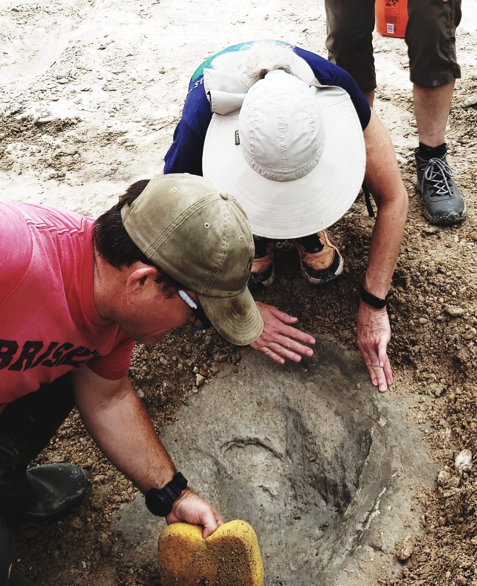
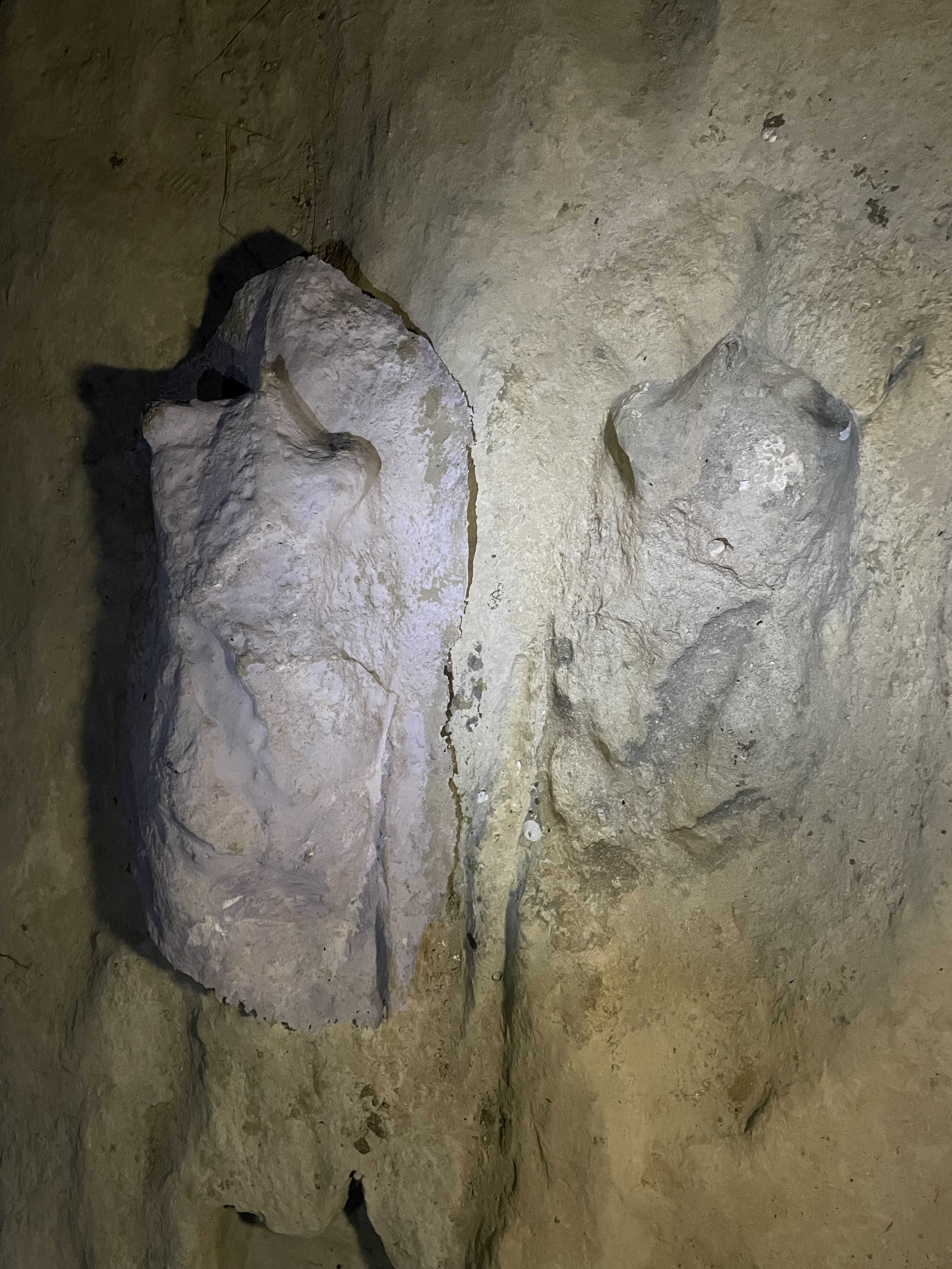
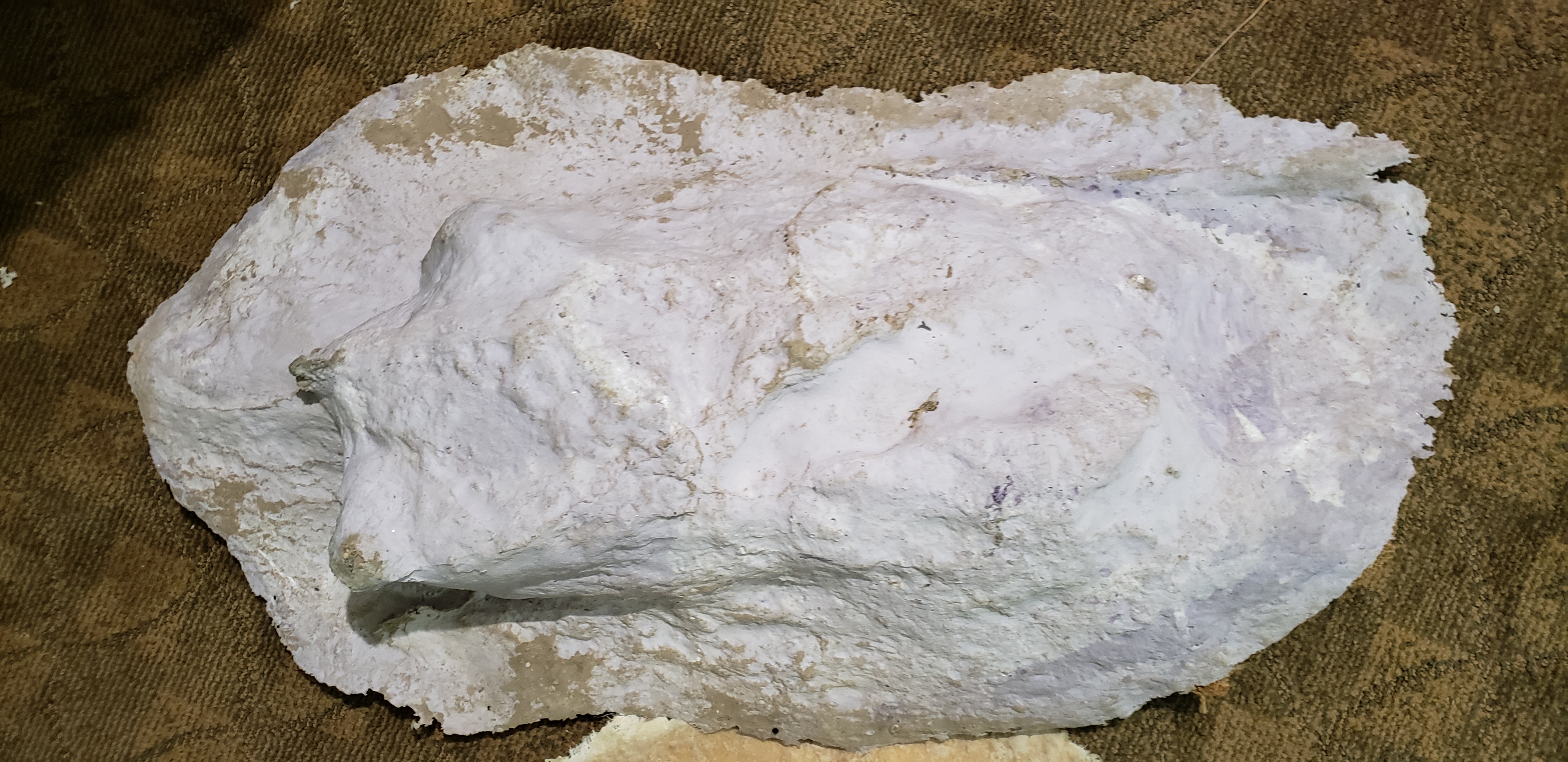
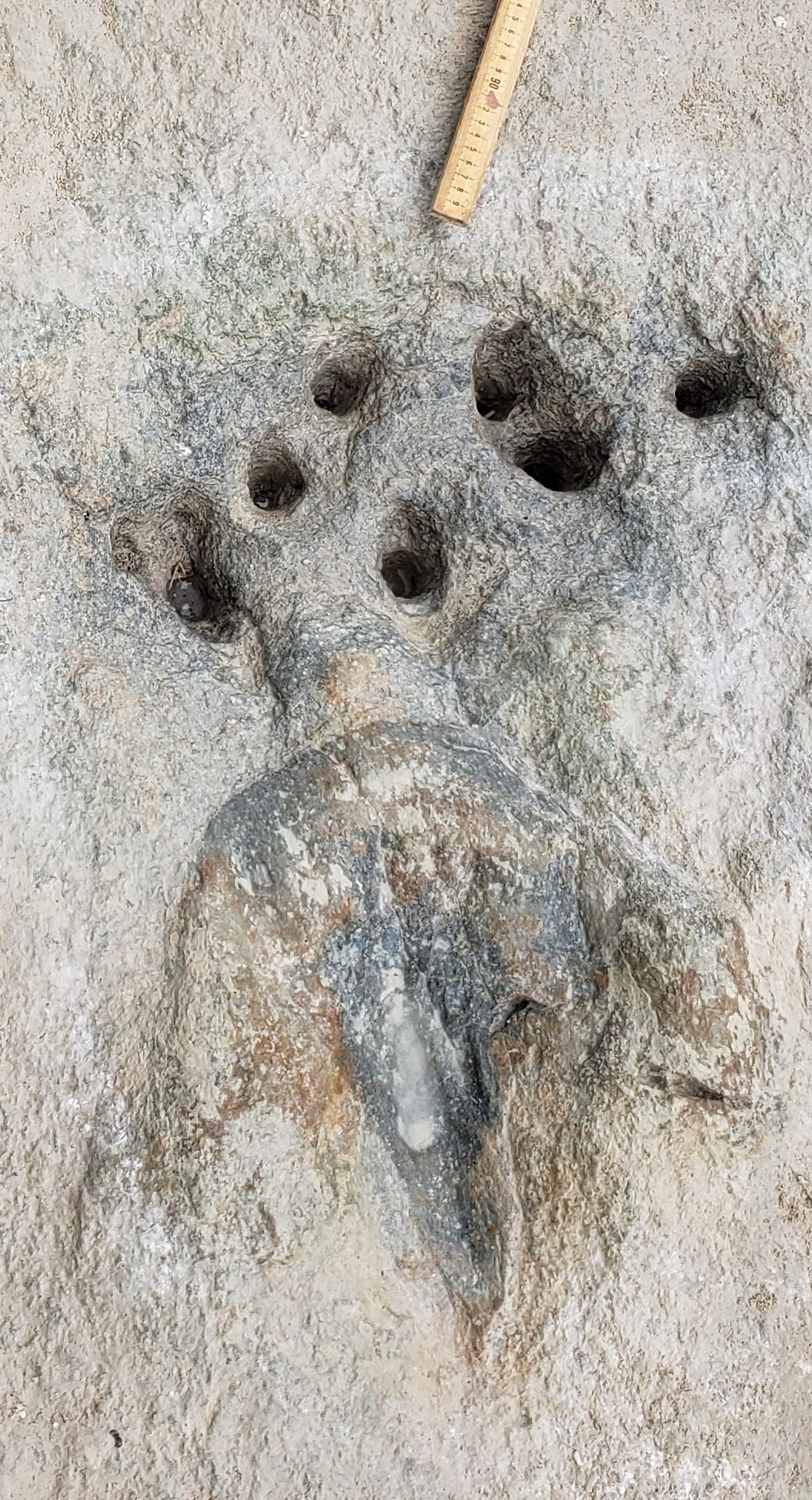
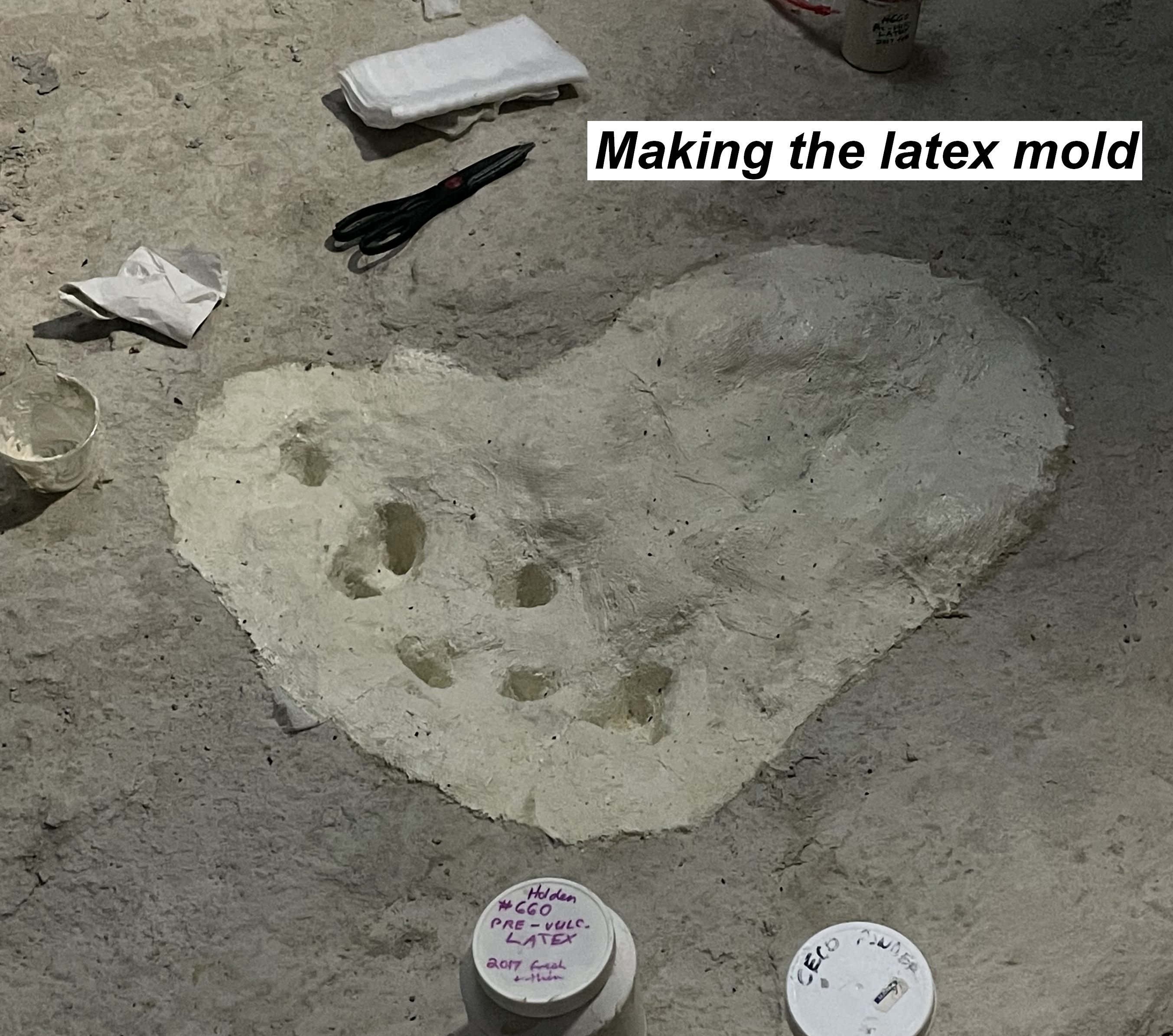
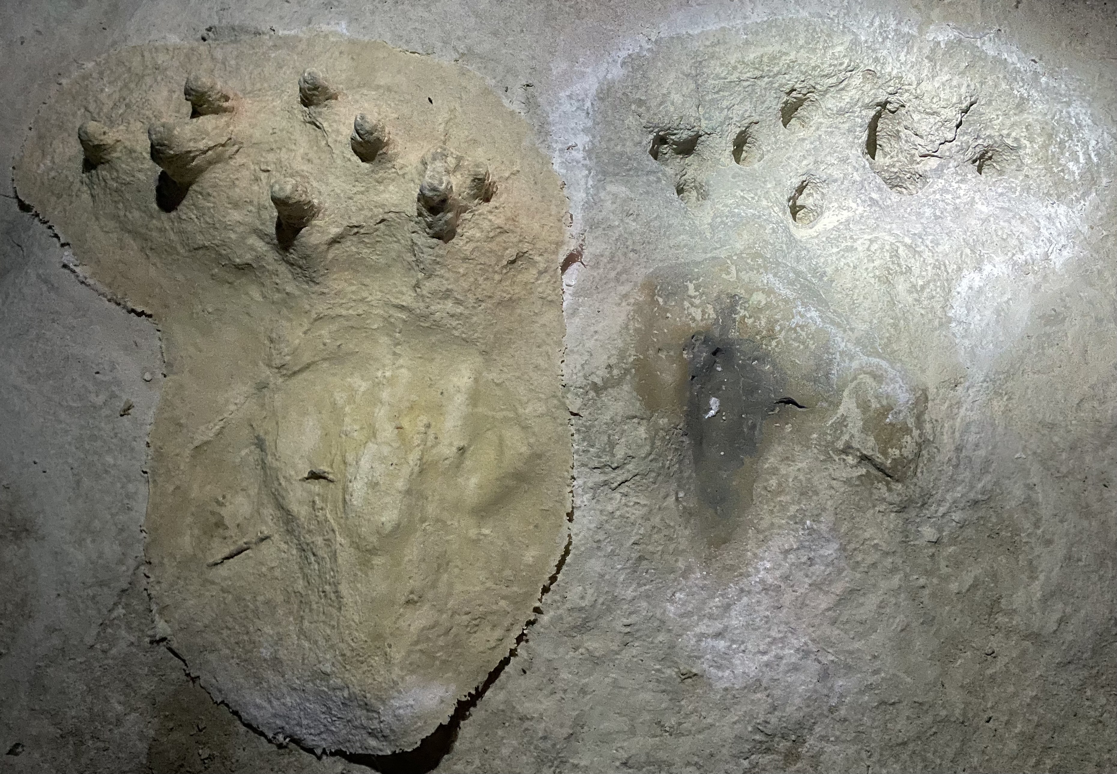
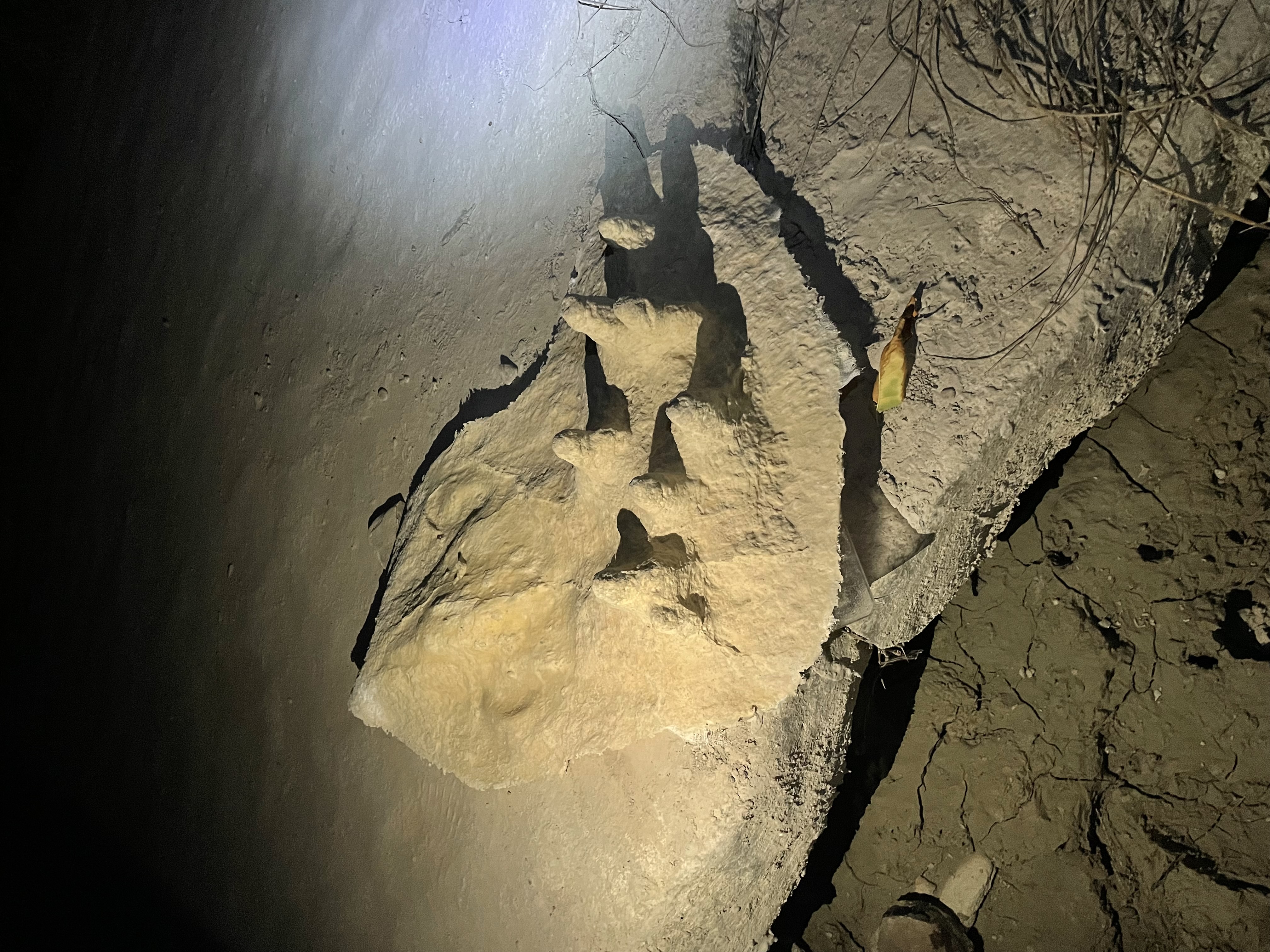
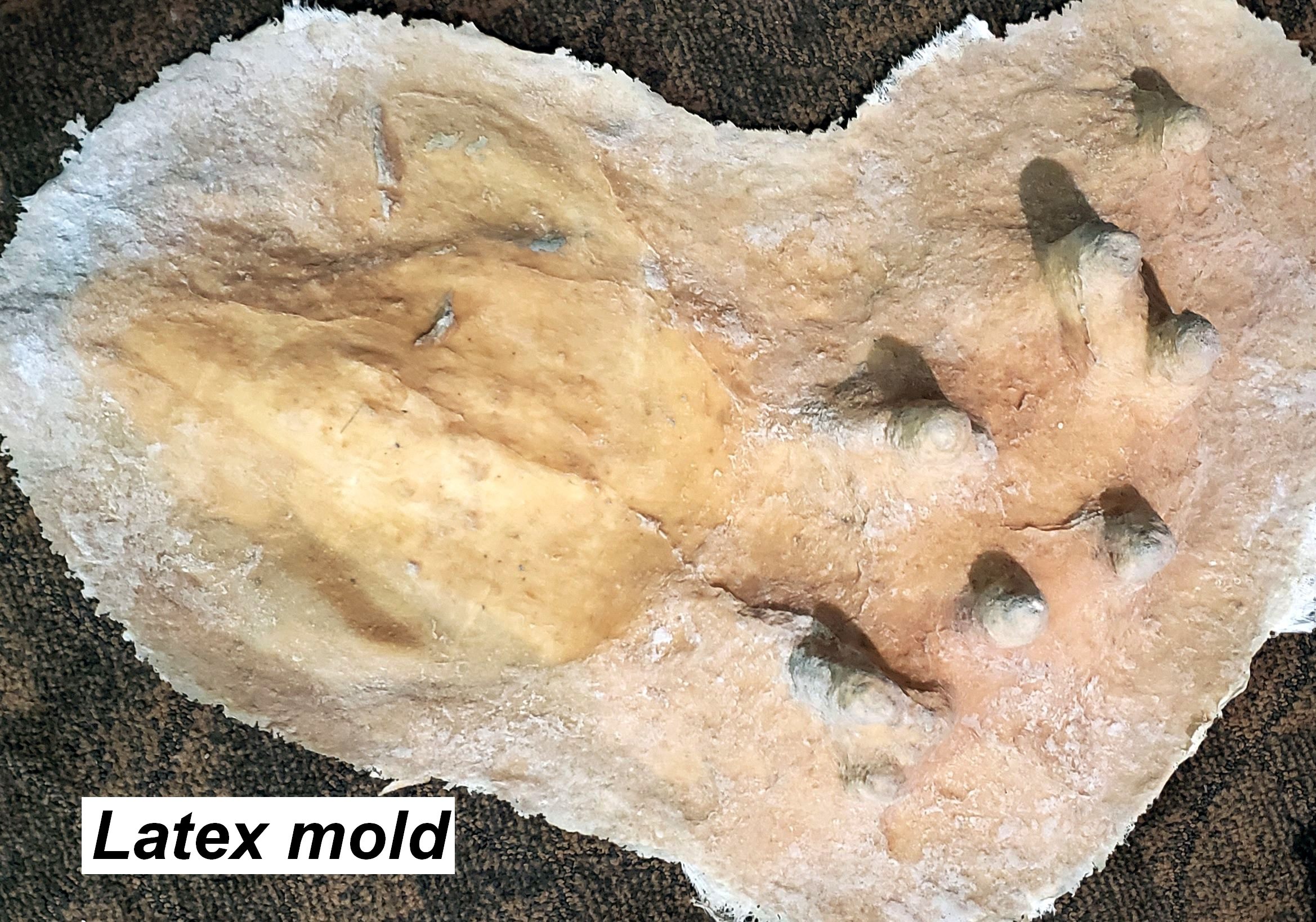
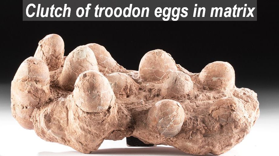
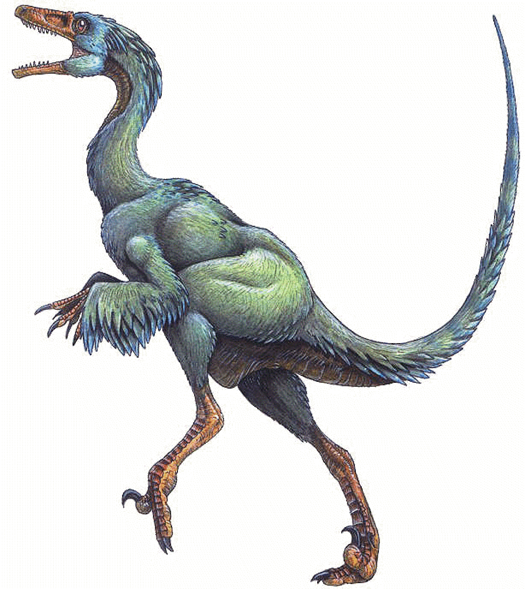
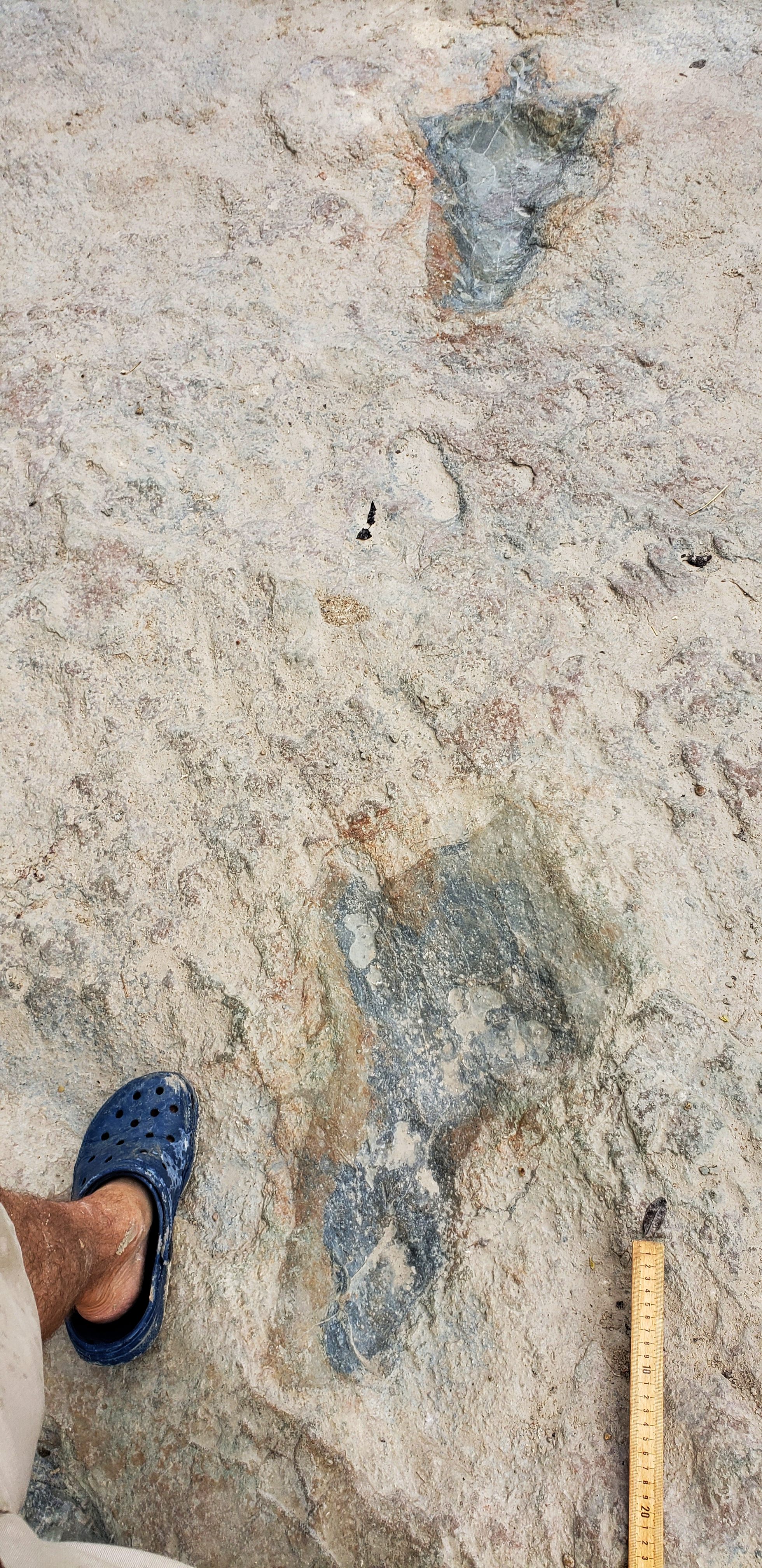
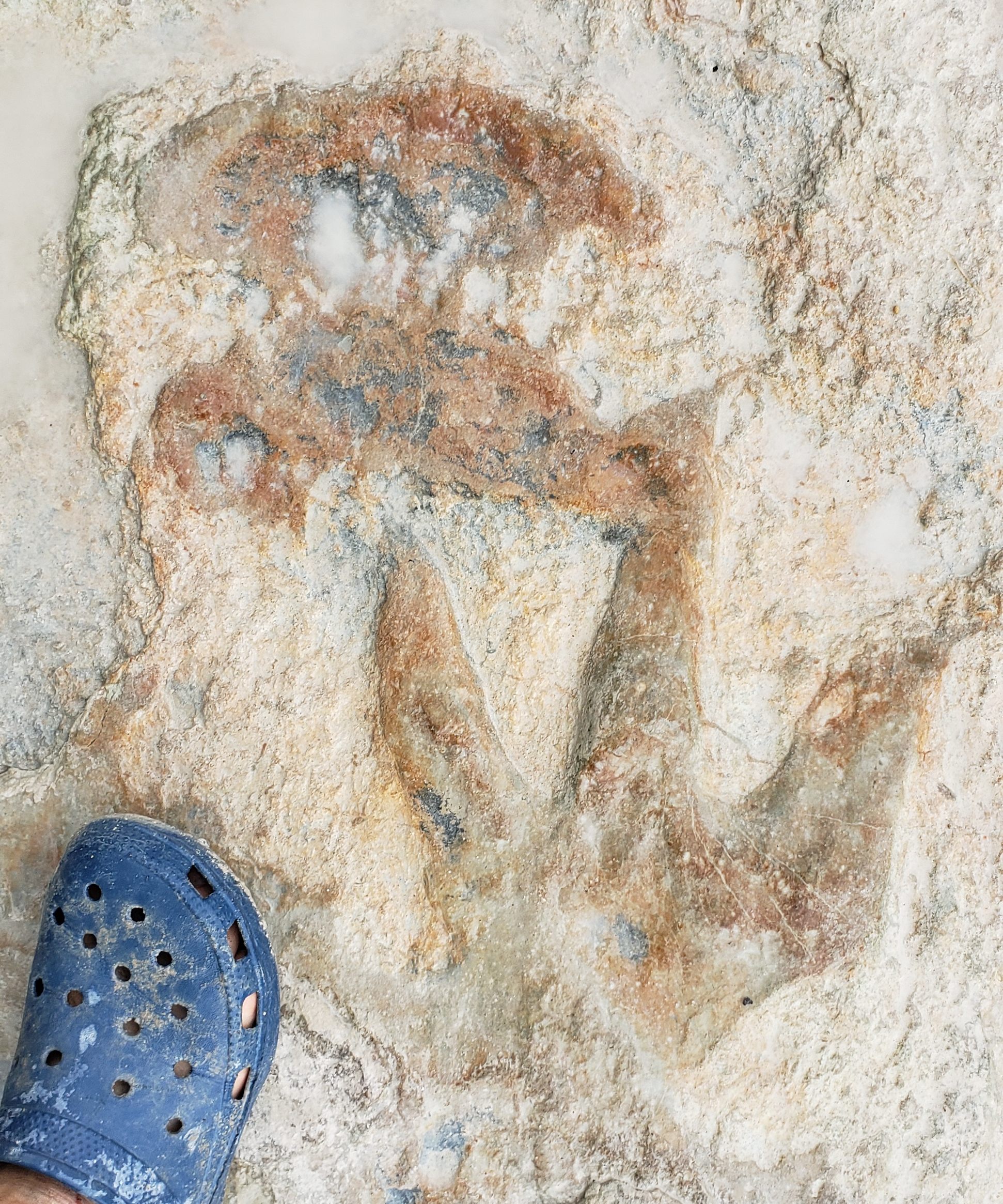
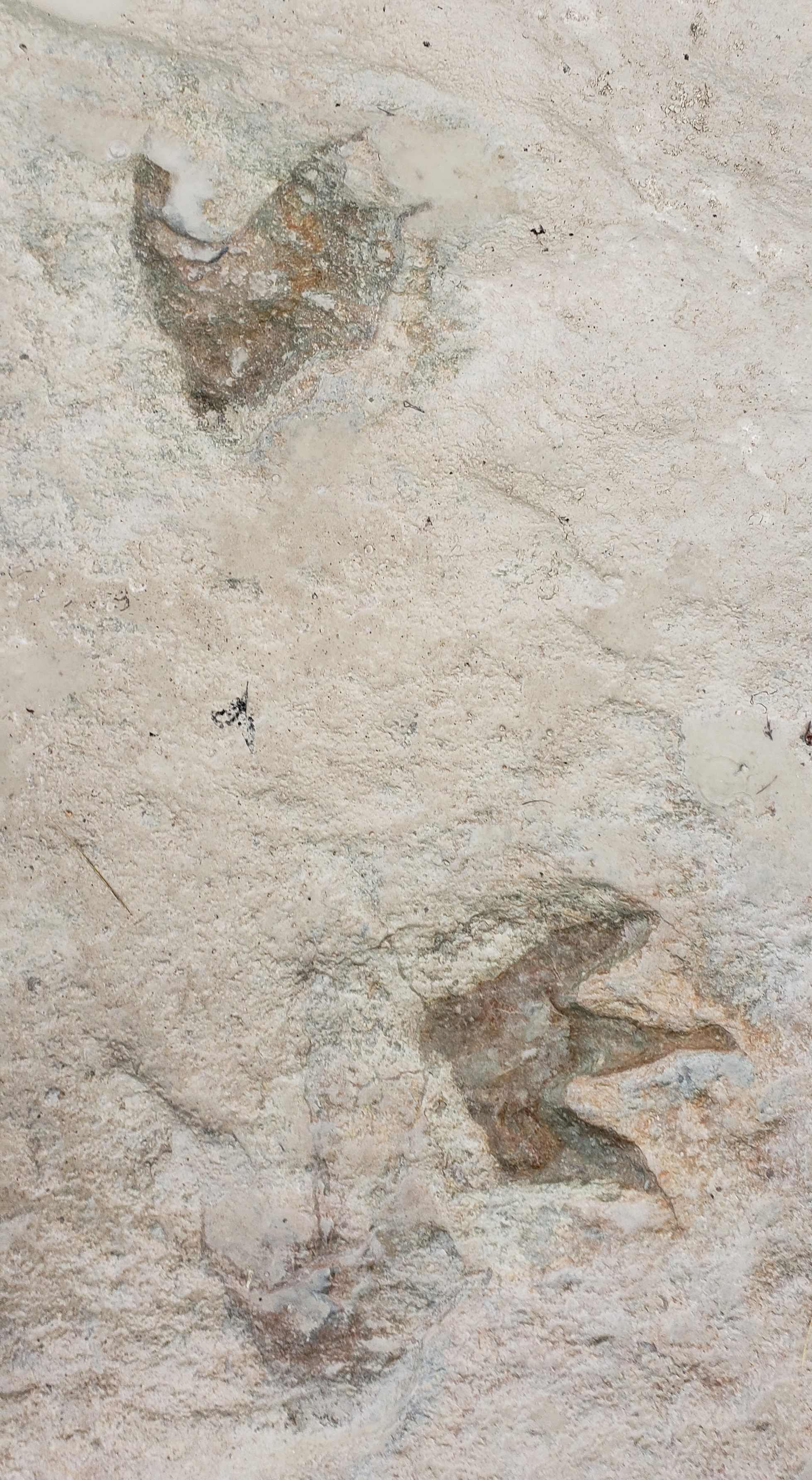
However, our most surprising and curious find was a collection of eight mysterious holes situated between two tracks in the A trail. Several of us (Joe Meeker, Pam Riddle, Phil Scoggins, Murray Cohen, and myself), carefully cleaned out each hole, after which we made a latex mold covering all of the holes and the closest infilled dinosaur track. Each hole was 2 to 3 inches deep and well-rounded at the bottom, which seemed to rule out their having been made by the sharp claws of a dinosaur hand or foot, pterosaur beak, or other vertebrate appendage. They also do not appear to be merely random depressions or invertebrate trace fossils. While debating what they could be, Joe Meeker noted that they seemed to most resemble an egg clutch of a Troodon dinosaur (a small theropod about the size of a collie), with the eggs no longer there of course. If so, the nest probbaly did not belong to the dinosaur that left the fairly large infilled tridactly tracks on either side of the holes, since that dinosaur would have been much larger than a typical Troodon. Although some dinosaur tracks (including "baby" tracks) have been found at some large dinosaur nesting sites, if the holes here are the remains of a nest, it may be the first time this has been found at a large dinosaur tracksite.
20220830_121102-cr-m.jpg 653.17 KB |
20220830_121254-m.jpg 1.93 MB |
20220830_121331cr.jpg 995.49 KB |
20220830_121340-cr-m.jpg 1.22 MB |
-cr.jpg)